|
ALL HIKERS
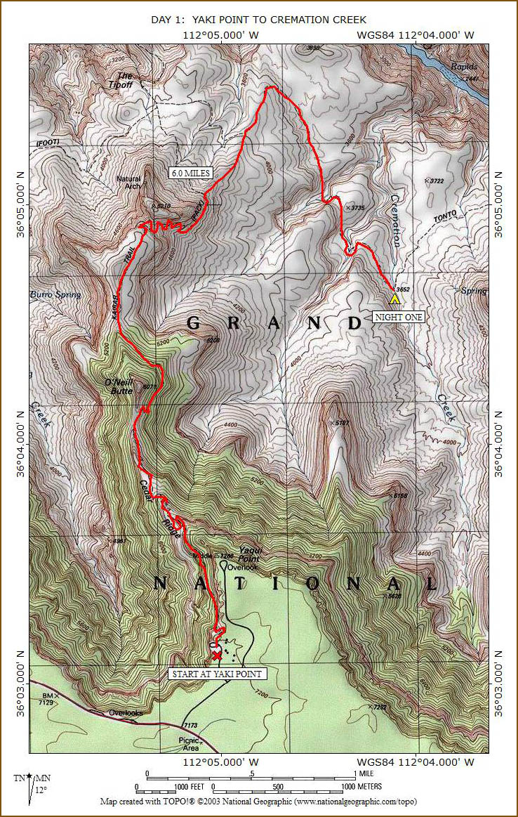
DAY 1:
YAKI POINT TO CREMATION CREEK |
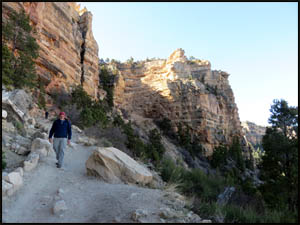
Richard and I drive out to Grandview
Point and leave my car there for us to use when we exit here in four days.
We drive back to the Maswik, have breakfast, and leave Richard's car in
the Backcountry Office parking lot. We then catch the 8:00 Hikers
Express Shuttle out to Yaki Point.
 |
 |
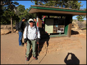
Richard Erbe at the trailhead
3-30-2018 @ 8:40 |
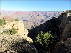
Looking down Canyon from the trailhead
3-30-2018 @ 8:40 |
After
a little picture taking, we head down the trail, which is easy walking and
well maintained.
 |
 |
 |
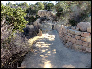
Starting down the trail
3-30-2018 @ 8:41 |
South Kaibab Trail
3-30-2018 @ 8:50 |
South Kaibab Trail
3-30-2018 @ 8:57 |
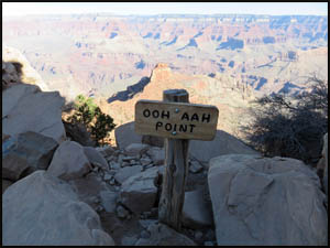
In no time
at all, we reach Ooh-Aah Point.
| |
 |
|
| |
Ooh - Aah Point
3-30-2018 @ 9:13 |
|
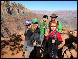
We then
meet a family doing a day hike down to Cedar Ridge. The views of
O'Neill Butte from here are fantastic.
 |
 |
A family on a day hike
3-30-2018 @ 9:18 |
A nice view of O'Neill Butte
3-30-2018 @ 9:19 |
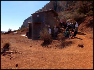
In less
than an hour after leaving the trailhead, we reach Cedar Ridge. The
line at the bathroom is quite long.
 |
 |
 |
Approaching Cedar Ridge
3-30-2018 @ 9:29 |
Cedar Ridge bathroom
3-30-2018 @ 9:35 |
Cedar Ridge
3-30-2018 @ 9:35 |
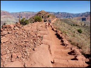
After a short
break, we continue down the trail, loop around O'Neill Butte (name for
Buckey
O'Neill), and walk the flat section out to Skeleton Point.
 |
 |
O'Neill Butte
3-30-2018 @ 9:53 |
North side of O'Neill Butte
3-30-2018 @ 10:20 |
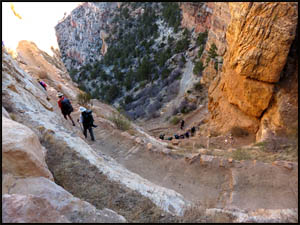
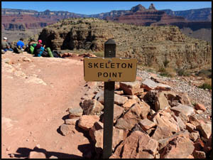
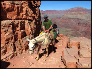
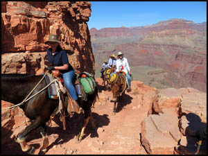
We start the
brutal downhill section below Skeleton Point and immediately run into the
morning mule riders coming uphill.
 |
 |
 |
Skeleton Point
3-30-2018 @ 10:46 |
Mule riders
3-30-2018 @ 10:49 |
Mule riders
3-30-2018 @ 10:50 |
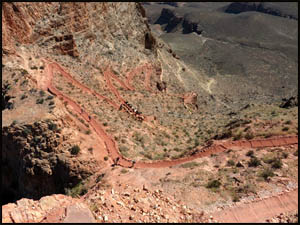
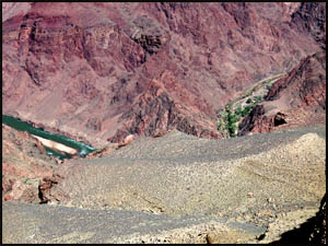
The view looking
down shows just how steep the many switchbacks are below here. We
can also see the Phantom Ranch area and the Colorado River flowing a
pretty green color. Then we have to wait at the side of the trail
for the pack mules to take a rest break.
 |
 |
 |
Switchbacks below Skeleton Point
3-30-2018 @ 10:50 |
The River and Phantom Ranch
3-30-2018 @ 10:51 |
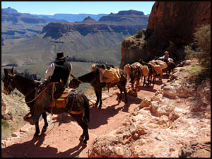
Mule pack team
3-30-2018 @ 10:55 |
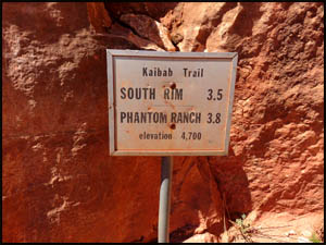
Finally,
after all those delays, the mule pack team passes us and Richard and
I get to make our way down all the switchbacks. We
find one trail distance sign, but I seem to remember that there used to be a lot of other
signs
displaying the various rock formations encountered. If I am
recalling correctly about the other signs, they
are all gone now. Zoroaster Temple north of the River is
magnificent.
 |
 |
Trail sign
3-30-2018 @ 11:05 |
Zoroaster Temple
3-30-2018 @ 11:43 |
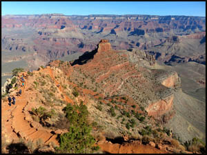
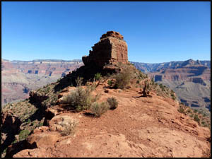
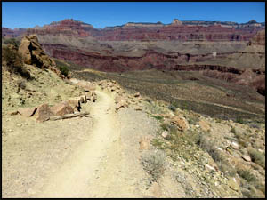
When we get
to the bottom of the switchbacks, we start to loop around Natural Arch.
Using Google Earth before our trip to check out the Cremation Shortcut, it
appears that the ridge line we want to take runs into the regular trail just as
the trail turns slightly to the northwest. Sure enough, it is
exactly where we expected it to be and is the only ridge line around.
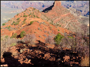
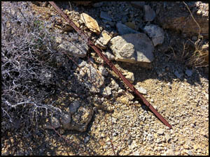
We step off the main trail and start walking down the ridge line to the
northeast. It is very easy walking. In a few minutes, we find
an old T-post and a lot of barbed wire. I can't imagine why anyone
would have spent the time and effort to fence off this area. In
about twenty minutes, we meet up with the regular trail. When
I got home from this trip, I used one of my topo map programs and
calculated that the distance from where we left the regular trail to the
Tipoff Point toilet is .6 miles if you stayed on the regular trail.
It is also .6 miles from that toilet to where we met the trail again.
That total distance is about 1.2 miles. I also calculated that we
walked about .2 miles on the Cremation Shortcut ridge line, so it looks
like we saved about one full mile or around a half-hour by taking the
Cremation Shortcut.
| |
 |
|
| |
Trail beside the Cremation Shortcut
3-30-2018 @ 11:43 |
|
 |
 |
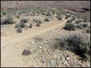 |
The Cremation Shortcut
3-30-2018 @ 11:48 |
Old T-post and barbed wire
3-30-2018 @ 11:50 |
Meeting up with the regular trail
3-30-2018 @ 12:09 |
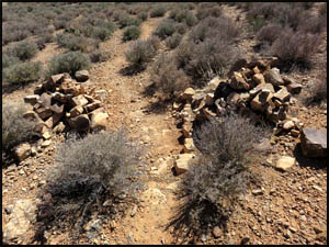
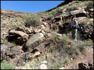
It's a
little farther over to the cairns marking the Cremation Use Area boundary than I
remembered. The Park Service used to let you camp anywhere east of these
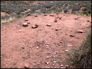
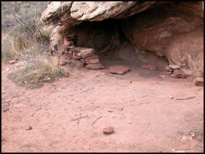
cairns. Just past those cairns, we stop at a very nice campsite where I
have camped on a prior hike. Richard and I have lunch in the shade of the
overhang area. I forgot to take pictures of this campsite, so these pictures
below are from a prior hike. This area is now off-limits to camping.
For the life of me, I can't figure out why the Park Service now prohibits
camping here. In any event, they purposely destroyed the little
rock wall shown in the last picture below and made the area unappealing for camping.
 |
 |
 |
Cremation Use Area cairns
3-30-2018 @ 1:08 |
Old campsite
3-30-2018 @ 1:30 |
Overhang at old campsite
3-30-2018 @ 1:30 |
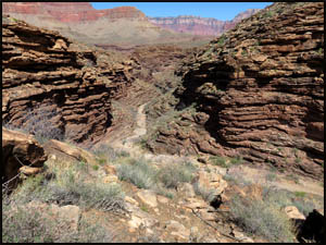
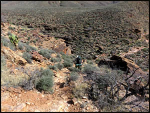
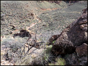
After
lunch, we continue on the trail until reaching the west arm of Cremation
Creek. I remember it being pretty steep and tough and my memory
is correct. This is no fun at all getting past this obstacle late in
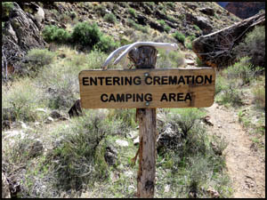
the day. The Park Service has erected a sign at the bottom
indicating that camping is now allowed. Richard and I are a little
tired and consider camping here. However, the only campsites we find are too
small, so we move on.
| |
 |
|
| |
West arm of Cremation Creek
3-30-2018 @ 2:20 |
|
 |
 |
 |
West arm of Cremation Creek
3-30-2018 @ 2:20 |
Trail sign in west arm
3-30-2018 @ 2:24 |
West arm of Cremation Creek
3-30-2018 @ 2:25 |
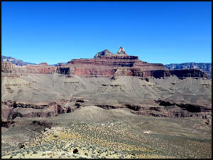
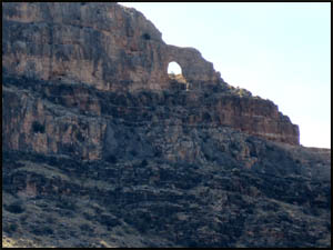
I have
always wondered how Natural Arch, which is at the base of the switchbacks
below Skeleton Point, got its name. When we look back in
that direction, we see a small rock arch on the north side. I have
never seen that before during my many trips down the South Kaibab Trail,
so it's possible that the trail passes too close to the base to allow
seeing the arch while on the regular trail.
| |
 |
|
| |
Natural Arch
3-30-2018 @ 2:39 |
|
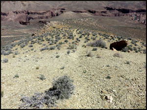
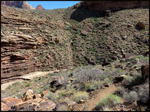
The middle
arm of Cremation Creek is also a steep climb, but not nearly as tough as the west
arm. Because we are both pooped, we would like to camp here, but again
we do not find a suitable
campsite. After climbing out of this drainage, we see our intended campsite
not too far away in the east arm of Cremation Creek.
 |
 |
Middle arm of Cremation Creek
3-30-2018 @ 3:03 |
East arm of Cremation Creek
3-30-2018 @ 3:03 |
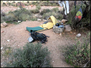
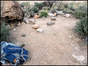
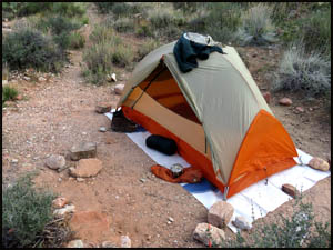
The east
arm of Cremation Creek is a flat, dry area with three or four very nice
campsites. We each pick out a spot and put our stuff down.
Then it's time to relax a while and have happy hour.
 |
 |
 |
Richard's bivy on night one
3-30-2018 @ 4:54 |
Camp on night one
3-30-2018 @ 4:54 |
My tent on night one
3-30-2018 @ 4:54 |
This should
be our toughest day of the entire hike. Tomorrow we are moving on to
Boulder Creek for the night. The Backcountry Office indicated that
the spring at Boulder is probably dry. That means we will have to
tank up with enough water when passing Lonetree to last us tomorrow night and the next
morning. Around 6:00 three girls come through camp headed for
Lonetree. They're going to have to hustle to get there before dark.
They are also camping tomorrow night at Boulder, so camping spots there
will be at a premium.
MAIN INDEX
|
HIKING INDEX
|
BACK TO
PREFACE |
FORWARD TO DAY
2
|
Copyright © Richard M. Perry, 2004-2024. All rights reserved. This web site, its text, and pictures may
not be copied without the express written consent of Richard M. Perry. |
|