|
ALL HIKERS
DAY 2: DAY
HIKE FROM MILE 8.0
TO CAPE SOLITUDE |
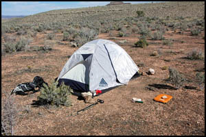
I am up early and leave camp
around 7:30 carrying only a daypack, two quarts of Gatorade, and snacks.
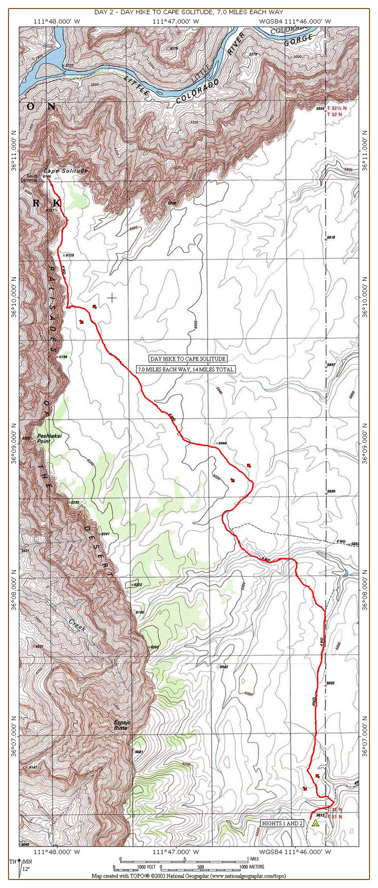
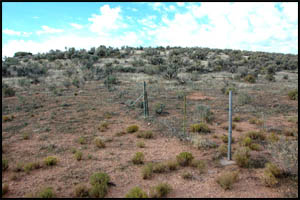
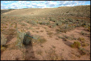
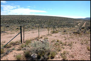
A few hundred yards down into this drainage I come to a fence with a gate.
I guess the Park Service put the fence here to limit access from the road on the
reservation. However, one entire section of the fence has been cut away.
So much for the attempt to limit access. I walk only a short distance down
the reservation road and then turn uphill to go through the second gate and back
onto Park property.
 |
 |
 |
Fence and gate
10-9-2007 @ 7:34 |
Fence with cut section
10-9-2007 @ 7:35 |
Second gate
10-9-2007 @ 7:40 |
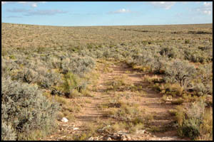
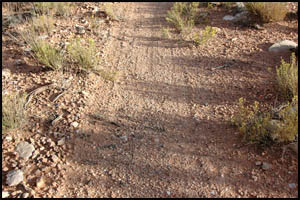
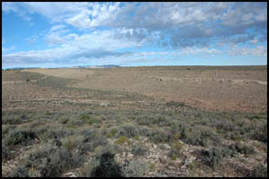
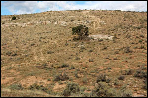
This entire area is substantially flat and it is very easy walking down the
abandoned road. However, there are plenty of fresh tire tracks on the road.
I have been playing with my GPS and am averaging about three miles per hour
so far.
 |
 |
Abandoned road
10-9-2007 @ 7:43 |
Abandoned road
10-9-2007 @ 7:44 |
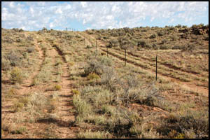
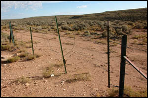
I soon reach two parallel roads, one on
the park side of the fence and one on the reservation side of the fence.
There is a gate between the two roads. Somehow I was expecting the
gate to be locked, but it is not. There are just some simple loops at
the top to lift off to reach the other side.
 |
 |
Parallel roads
10-9-2007 @ 8:11 |
Gate
10-9-2007 @ 8:12 |
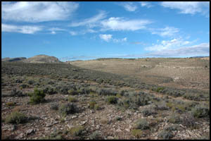
About an hour into my hike, I come to the only significant drainage on the
hike today. The far side is much steeper than these pictures make it
seem. I am surprised that vehicles could get up that incline.
 |
 |
 |
First big drainage
10-9-2007 @ 8:22 |
First big drainage
10-9-2007 @ 8:22 |
Steep side of drainage
10-9-2007 @ 8:32 |
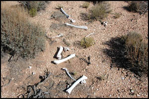
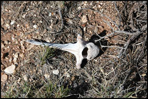
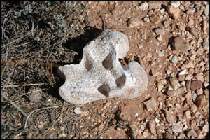
While the walking is easy, it is a long ways there. Just before
reaching Cape Solitude I find some animal bones at the side of the trail.
I assume these belonged to a larger animal, possibly an elk or a deer.
 |
 |
 |
Animal bones
10-9-2007 @ 10:08 |
Animal bones
10-9-2007 @ 10:08 |
Animal bones
10-9-2007 @ 10:08 |
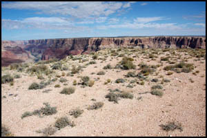
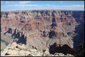
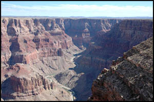
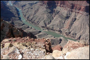
I arrive at Cape Solitude a little after 10:00. The views are awesome.
I scramble down to a lower ledge to have a better view. The Colorado
River is running a bright green color. The Little Colorado River
appears to be about half-way between a muddy, brown color and a color free
of silt. After some snacks, it's time to take a few pictures. I
climb to the top again and move a little ways to get an unobstructed view of
the actual confluence. I set up two five-picture photo-galleries
of the area in case some people's browsers do not support larger galleries.
 |
Click either
picture
to see all five
pictures in this
photo-gallery
of the confluence
of the Colorado River
and Little Colorado River |
 |
Cape Solitude
10-9-2007 @ 10:12 |
|
Confluence area
10-9-2007 @ 10:27 |
 |
Click either
picture
to see all five
pictures in this
photo-gallery
of the confluence
of the Colorado River
and Little Colorado River |
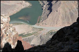 |
Little Colorado River
10-9-2007 @ 10:31 |
|
Confluence
10-9-2007 @ 10:31 |
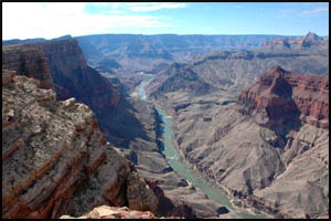
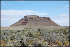
I look for a brass U.S. Geological Survey marker, but do not find one. I leave Cape Solitude and start back. Just a few hundred yards down
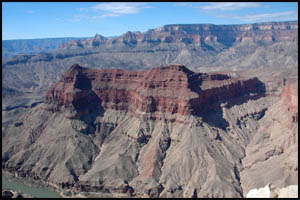
the road I come to another area with fabulous views across and downstream in
the Colorado River. Tanner Rapids is at the far end and Palisades
Creek is at the mid-point. Temple Butte is directly across the river from
me.
 |
 |
 |
Colorado River
10-9-2007 @ 10:37 |
Temple Butte
10-9-2007 @ 10:37 |
Colorado River
10-9-2007 @ 10:38 |
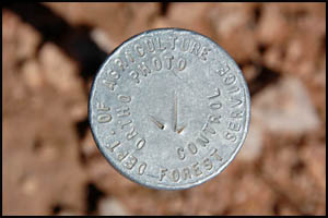
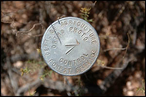
About two hours later as I approach the gate by the parallel roads, I notice
what I first thought were some Geological Survey markers. There is one
by each side of the gate. Upon further inspection, the wording on the
devices seems to imply that these are part of some photographic system.
I wonder if this is how the National Park Service attempts to control access
through this gate.
 |
 |
 |
1st Forest Service device
10-9-2007 @ 12:49 |
Gate by parallel roads
10-9-2007 @ 12:49 |
2nd Forest Service device
10-9-2007 @ 12:49 |
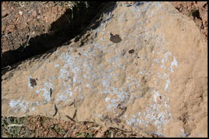
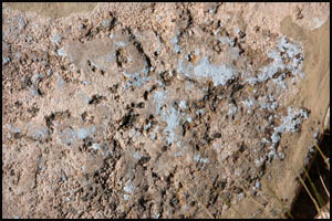
I later come across some interesting blue lichen on these rocks. I
have seen plenty of lichen in various colors in the Canyon, but never a blue
color like this. These pictures do not accurately reflect the darkness
of the blue.
 |
 |
Blue lichen
10-9-2007 @ 1:15 |
Blue lichen
10-9-2007 @ 1:15 |
I am approaching the first fence and gate I encountered early this morning.
Gold Hill is quite near and the view of it, unlike at camp, is unobstructed
here. Instead of going down the road and through the gate, I am going
to walk directly toward camp and try to save a little time. I arrive
in camp shortly and probably cut five minutes or so off my time by taking
this more direct route.
 |
 |
 |
Gold Hill
10-9-2007 @ 1:20 |
Camp in the distance
10-9-2007 @ 1:22 |
Camp
10-9-2007 @ 1:29 |
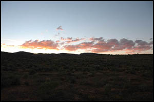
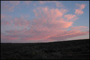
I lounge around camp the rest of the afternoon. Like last night, there
aren't many clouds so this is about all the sunset there is.
 |
 |
Second night sunset
10-9-2007 @ 5:59 |
Second night sunset
10-9-2007 @ 6:03 |
MAIN INDEX
|
HIKING INDEX
|
BACK TO DAY 1
|
FORWARD TO DAY 3
|
Copyright © Richard M. Perry, 2004-2023. All rights reserved. This web site, its text, and pictures may
not be copied without the express written consent of Richard M. Perry. |
|