|
I am up around 6:00 at my Mather
campsite and head to Desert View. I drive about a half-mile
down the old jeep road that comprises the trail and park beside the
sewage disposal ponds. It's a little too rough to drive any
farther in my car. I look more like a pack mule than a hiker
as I start out. I've got two quarts of Gatorade in my pack's
mesh side-pockets, three quarts of water in a Platypus container
clipped to one front pack strap and another three quarts clipped to
the other front strap, my GPS also clipped to a front strap, a day-pack
strapped to the back, and my Nikon D70s around my neck.
 |
 |
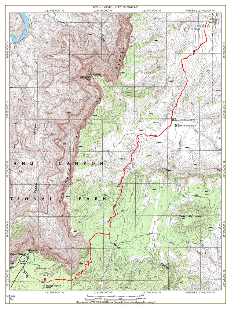
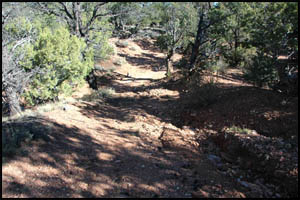
My car at the start
10-8-2007 @ 7:52 |
The trail (old jeep road)
10-8-2007 @ 8:07 |
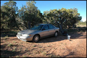
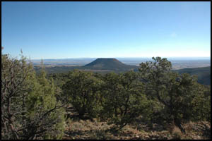
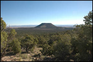
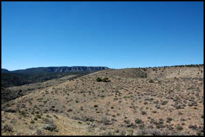
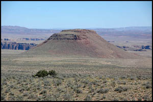
As I descend the rocky road
switchbacks, the views of Cedar Mountain are impressive.
While there is a trail up the side of Cedar Mountain, it is very
steep. Scaling it would be quite the adventure.
 |
 |
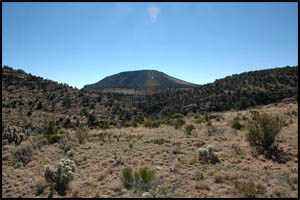 |
Cedar Mountain
10-8-2007 @ 8:12 |
Cedar Mountain
10-8-2007 @ 8:32 |
Cedar Mountain
10-8-2007 @ 10:05 |
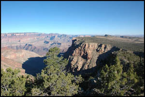
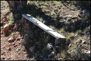
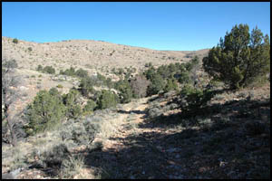
There are really nice views to
the south as I walk along the road. Someone even built a small
bench at the side of the trail.
 |
 |
Southerly view from trail
10-8-2007 @ 8:13 |
Bench beside trail
10-8-2007 @ 8:23 |
Shortly after reaching the
bottom of the switchbacks, you come to a trail junction. Going
straight ahead takes you to Cedar Mountain. I turn left for
the trail to Comanche Point and Cape Solitude. The road is
open to motorized vehicles up to this point.
 |
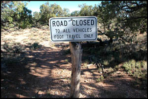 |
Trail junction to Cedar Mountain
10-8-2007 @ 8:51 |
Sign at trail junction
10-8-2007 @ 8:51 |
About fifteen minutes after
turning at the trail junction, I notice my right leg is slightly
wet. A little while later, my leg is really wet. On a
previous hike, I had the seam of one of my Platypus containers
separate and start leaking. I wonder if that has happened
here. That prior episode is why I carry this much water in two
separate containers. I don't want to have all my eggs in one
basket, so to speak. I look down and notice that the cap on
the container is missing. Geez Louise, you would think I would
have tightened it down properly. I find a large stick to
partially plug the opening. I then hold that container out
with my hand as I walk to minimize the leakage. I'm also going
to drink from this container instead of my Gatorade bottles to lower
the water level. Maybe on the way back I can look for the cap.
Fat chance of finding it, though.
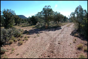
Apparently the entire road to
Cape Solitude was open to motorized traffic until about fifteen
years ago. The two to three mile section from the last trail
junction to the cairn at the five-mile point is a little rough.
It has lots of ups and downs, goes through several creek bottoms,
and has a lot of exposed boulders.
 |
 |
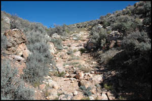 |
Rough section of trail
10-8-2007 @ 8:57 |
Rough section of trail
10-8-2007 @ 9:26 |
Rough section of trail
10-8-2007 @ 10:19 |
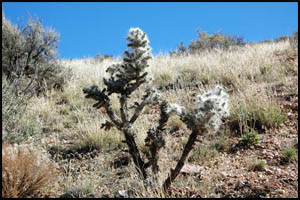
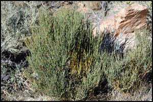
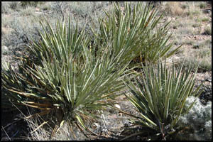
I haven't seen any blooming
flowers, but that is to be expected this time of year. There
is still the usual variety of desert plants.
 |
 |
 |
Teddy Bear
Cholla
10-8-2007 @ 10:20 |
Mormon Tea
10-8-2007 @ 10:20 |
Yucca
10-8-2007 @ 10:22 |
The
Desert View Watchtower has been in view most of the trip so far.
It is slowly fading into the distance behind me.
 |
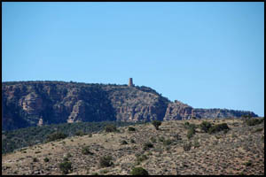 |
Desert View Watchtower
Wide angle lens
10-8-2007 @ 10:26 |
Desert View Watchtower
Full zoom
10-8-2007 @ 10:26 |
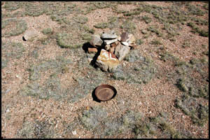
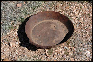
When I finally get out of the
creek bottoms and walk up a slight rise, I come to a cairn and old
pan at the five-mile point. The trail branches to the left for
Comanche Point. I take the right fork headed for Cape
Solitude.
 |
 |
Trail junction cairn (5-mile point)
10-8-2007 @ 10:31 |
Old pan at trail junction cairn
10-8-2007 @ 10:31 |
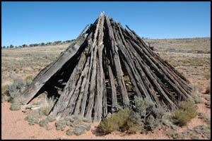
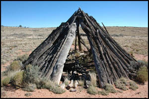
After rounding a small knoll, I
see a Navajo Hogan several hundred yards off the trail. I
leave my pack on the trail and walk to the Hogan. At about
eight feet tall, it is quite a bit higher than I expected.
Originally a Hogan was the primary traditional home of the Navajo
people. For those who practice the Navajo religion, the Hogan
is considered sacred and is used for private ceremonies.
 |
Click either
picture to
see all nine
pictures of the
Navajo Hogan |
 |
Navajo Hogan
10-8-2007 @ 10:55 |
|
Navajo Hogan
10-8-2007 @ 10:56 |
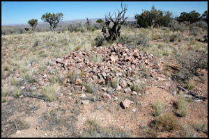
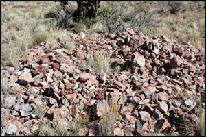
Just a few hundred feet down the
trail is an agave roasting pit. I wonder if the Navajos
purposely built the Hogan near the roasting pit.
 |
 |
Agave roasting pit
10-8-2007 @ 11:11 |
Agave roasting pit
10-8-2007 @ 11:11 |
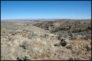
I then crest a small ridge and
start downhill. Gold Hill is now in view and remains the
dominant feature for most of the remainder of this hike. I
plan to camp at the eight-mile point, which is adjacent to Gold
Hill.
 |
 |
 |
Gold Hill
10-8-2007 @ 11:15 |
Gold Hill
10-8-2007 @ 11:36 |
Gold Hill
10-8-2007 @ 12:23 |
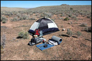
As I approach the eight-mile
point, I am just above a large drainage. There are nice flat
spots to the side, so I make camp here for two nights. The
view of Gold Hill is obscured by a ridge to the south.
 |
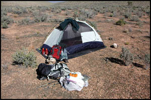 |
First and second night's campsite
10-8-2007 @ 1:02 |
First and second night's campsite
10-8-2007 @ 1:17 |
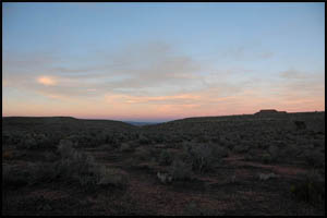
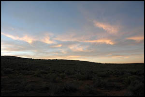
There aren't many clouds, so there's not much of a sunset tonight.
 |
 |
First night's sunset
10-8-2007 @ 5:57 |
First night's sunset
10-8-2007 @ 5:59 |
|