|
ALL HIKERS
DAY 2 -
COTTONWOOD CAMP TO BRIGHT ANGEL CAMPGROUND |
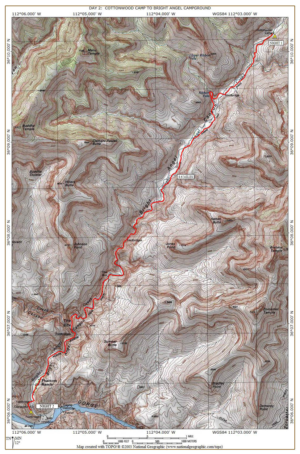
We eat, pack,
and leave camp around 8:50. In about an hour, we reach the Ribbon
Falls cutoff trail. I have heard that the bridge going across the
creek is closed. It's worse than that.
The bridge is gone! Apparently, a few years ago the Park Service
felt the bridge was unsafe and completely removed it. That is
going to make it very challenging for us to get across the creek to see
Ribbon Falls. We climb down from where the bridge was and make our way through the brush
until we reach the creek. The water in the creek is a little deep
and is flowing swiftly. We spend about twenty minutes looking for
a safe way to cross the creek, but do not find one. We eventually give up,
which may be a good thing. We later meet two guys who were soaked
from head to foot after falling into the creek trying to cross it.
| |
 |
|
| |
Trail sign
10-13-2021 @ 9:58 |
|
We return to
the trail and head south. Unfortunately, we now have
to climb and descend "Asinine Hill." It is appropriately named
because you have to climb this very steep hill, only to have to make a
steep descent back to your original elevation. A little further
down the trail we come to another sign indicating that Ribbon Falls can
be accessed by crossing the creek here and backtracking to the Falls.
Since we wasted a lot time trying to cross the creek earlier, we decide
to skip Ribbon Falls and continue on. I tell Beth and
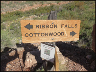
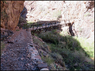
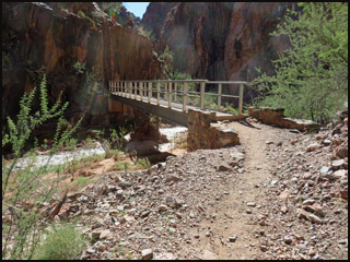
Curt to go on ahead as they will be much faster than I will. I
trudge along, eventually coming to the first of several bridges I have
to cross.
 |
 |
|
The first bridge
10-13-2021 @ 11:14 |
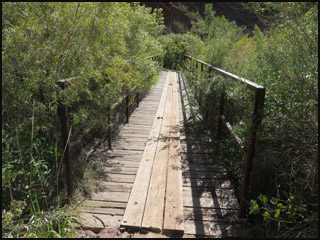
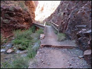
The second bridge
10-13-2021 @ 11:15 |
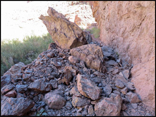
Just a little
later I have to cross a small rock slide area, which is no problem at all.
| |
 |
|
|
|
A small rock slide
10-13-2021 @ 11:31 |
|
This area of
the Canyon is called "The Box" due to its high walls.
New hikers to this area probably feel like ants trapped at the bottom of
a box. I cross two
more bridges and seem to be making a little headway.
 |
 |
|
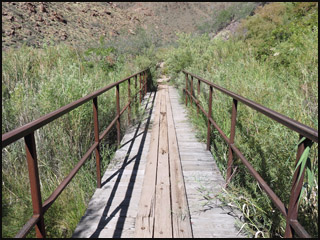
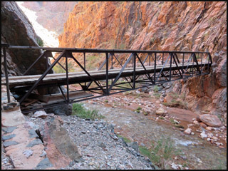
The third bridge
10-13-2021 @ 12:00 |
The fourth bridge
10-13-2021 @ 12:11 |
I sit down
on a low rock wall beside the trail and have lunch. I needed that
break anyway. After crossing two more bridges, I feel I'm getting
pretty close to Phantom Ranch.
 |
 |
|
The fifth bridge
10-13-2021 @ 1:40 |
The sixth bridge
10-13-2021 @ 1:49 |
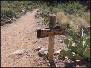
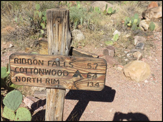
When you come
to these trail signs, you know you are really close. I round the
corner of the Canteen at Phantom Ranch and find Beth and Curt sitting on a bench.
They got here a couple of hours ago and have already staked out a nice campsite.
Like yesterday, I am pretty tired, so a more lengthy break is now in
order. Beth goes and gets me some lemonade at the side window.
 |
 |
 |
|
Trail sign
10-13-2021 @ 2:03 |
Trail sign
10-13-2021 @ 2:04 |
Trail sign
10-13-2021 @ 2:15 |
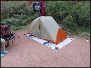
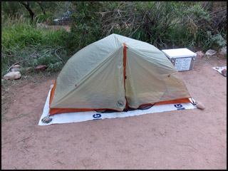
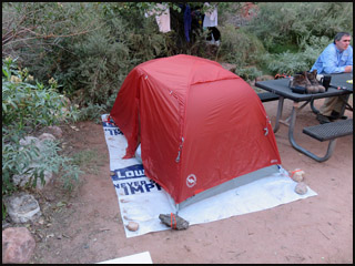
After my
extended break, we head to camp and I set up my tent.
 |
 |
 |
|
Beth's tent
10-13-2021 @ 4:35 |
Curt's tent
10-13-2021 @ 4:35 |
Richard's tent
10-13-2021 @ 4:35 |
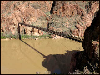
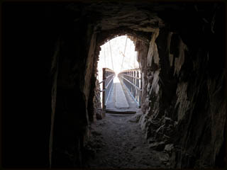
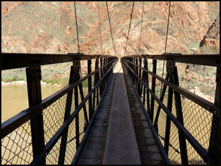
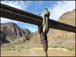
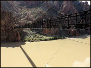
While I rest
more at camp, I suggest that Beth take Curt over to see the Kaibab
Suspension Bride, often called the "Black Bridge." It was built in
1928 to replace a frail and poorly built wooden suspension bridge.
In order to get the one-ton, 1.5 inch suspension cables to the bridge
build site, the Park Service enlisted 42 men, mostly Havasupai Indians,
to carry each cable on their shoulders and snake their way down the
South Kaibab Trail. The bridge was designed to carry a load of 750,000
pounds. Click here to
see a picture of both suspension bridges before the original bridge was
torn down.
 |
 |
|
Kaibab
Suspension Bridge
10-13-2021 @ 4:55 |
Tunnel - Kaibab
Suspension Bridge
10-13-2021 @ 4:57 |
 |
 |
 |
|
Kaibab Suspension
Bridge
10-13-2021 @ 4:58 |
Cables on Kaibab
Suspension Bridge
10-13-2021 @ 5:00 |
Kaibab Suspension
Bridge
10-13-2021 @ 5:05 |
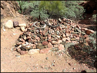
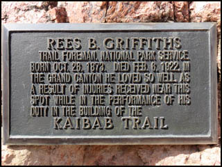
They then
stop by the grave of Rees Griffiths, a trail foreman who died there in
1922.
 |
 |
|
Trail worker
grave
10-13-2021 @ 5:10 |
Trail worker
plaque
10-13-2021 @ 5:11 |
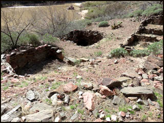
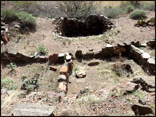
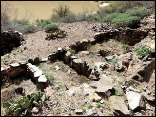
Nearby are
some Anasazi ruins. I am surprised that they have survived all the
floods that must have taken place here over time. The circular
depression in the middle picture below is called a "Kiva."
 |
 |
 |
|
Anasazi ruins
10-13-2021 @ 5:12 |
Anasazi ruins
10-13-2021 @ 5:12 |
Anasazi ruins
10-13-2021 @ 5:13 |
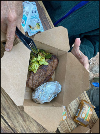
It's getting
close to supper time at Phantom Ranch, so I head over that way.
Hopefully, Beth and Curt will know to meet me over there. Phantom
Ranch opened back up to in-house dining last month, but now has returned
to take out meals only. I know everyone will be glad when this
Covid pandemic is over. Beth and Curt arrive just as they are
announcing that our meals may be picked up at a side window. My
steak dinner is entirely packed in a cardboard box. As usual it is
great despite the packaging.
| |
 |
|
|
|
The steak dinner
at Phantom Ranch
10-13-2021 @ 5:35 |
|
We go back to
camp and I head to bed early. We also have breakfast tomorrow
morning at Phantom Ranch. Fortunately, it is the late
breakfast, so we will not have to get up too early. Tomorrow should be a much shorter day.
MAIN INDEX
|
HIKING INDEX
|
BACK TO DAY 1 |
FORWARD TO DAY 3
|
Copyright © Richard M. Perry, 2004-2024. All rights reserved. This web site, its text, and pictures may
not be copied without the express written consent of Richard M. Perry. |
|