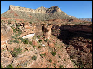
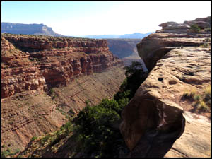
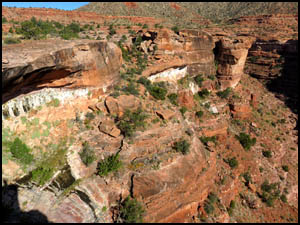
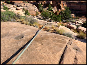
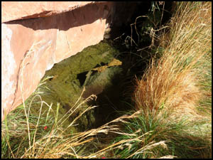
The strong wind we had yesterday afternoon continued all night long. Richard and I have splurged and brought pre-cooked bacon for part of each breakfast. Back home I cut a Teflon coated cookie pan in half to use to heat our bacon. It works very well and our bacon is indeed yummy. After breakfast, Richard wants to show me Saddle Horse Spring, which is nearby. He was last there several years ago. We strike out from camp in an easterly direction. After walking a while, I realize that my Garmin hand held GPS might show this feature. I did remember to download all my topo maps onto it before coming out here. Sure enough, it does show the spring. That helps out a lot and using it we proceed directly toward the spring. Pretty soon we come to the edge of a large ravine that I later find out is Saddle Horse Canyon. We can see the spring lower down in the left hand corner of the last picture below.
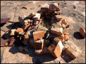
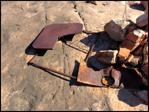
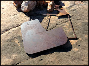
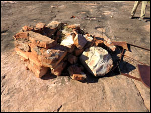
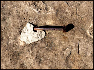
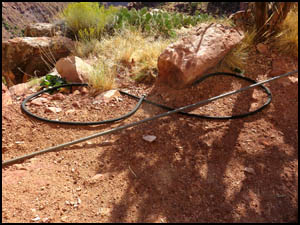
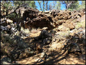
In short order, we then come to a pile of rocks, some metal pieces, and two bolts embedded in the rock.
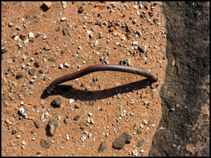
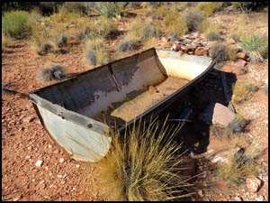
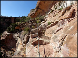
A horse trough and a long length of one inch galvanized pipe going over the rim edge are close by. It's clear from those two things that someone long ago was pumping water from the spring up into the horse trough. However, we have no idea what the things shown in the six pictures above were for.
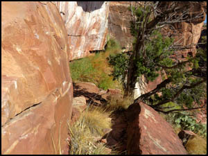
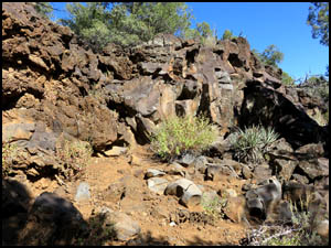
Richard and I make our way from the rim down a narrow trail leading to the spring.
Saddle Horse Spring appears to be two or three feet deep. Nearby is a flexible black hose that apparently fastened between a pump in the spring and the galvanized pipe going to the rim and the horse trough. There is a lot of that galvanized pipe in twenty-foot sections, so someone went to a lot of effort to transport that here and assemble it. It would have been heavy and expensive.
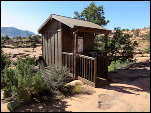
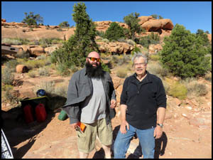
We then head back to the rim and toward camp. After passing the bathroom in the lower campground, we meet Andrew and Stephen, who are just getting ready to leave.
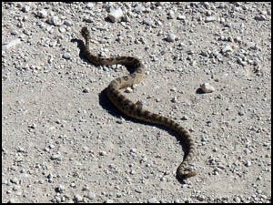
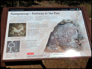
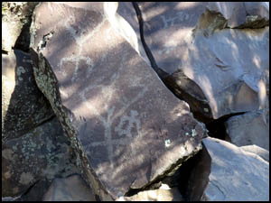
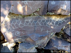
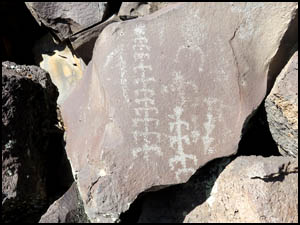
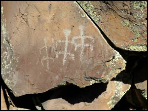
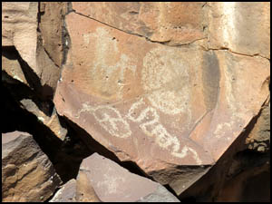
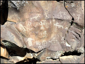
After lunch, Richard is driving us to a place purported to have the most petroglyphs in all of Arizona named "Nampaweap." The word means "Foot Canyon" in Paiute. We start driving north, but have to stop when all the cars in front of us have stopped and are blocking the road. We get out of the car and find that a rattlesnake is taking his time crossing the road.
We turn left at the Mt. Trumbull sign and continue a while until reaching the parking lot. Some guy who arrived just ahead of us has four or five big dogs that are a little threatening at first, but then they calm down some. The fencing at the parking area is brand new. We check out the sign at the gate and then head down the trail.
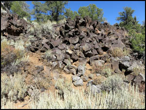
It is three-fourths of a mile one-way on a very smooth trail until we come to another path leading down to a series of huge boulders that look like they came out of a volcano.
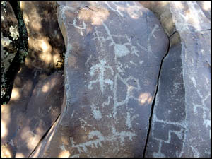
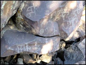
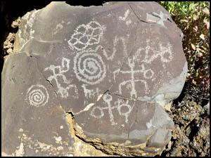
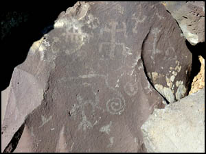
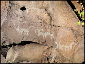
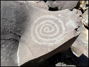
Since I'm going to be taking a lot of pictures, I hold my camera in my hand and put the camera case in my pocket. A lot of scrambling and climbing over the boulders is necessary in order to get pictures of the petroglyphs. There certainly are a lot of them here. A few of the better ones are shown below.
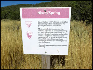
When I'm done taking pictures, I realize that my camera case has come out of my pocket and fallen somewhere in the boulder field. Geez Louise, this means I'm going to have to backtrack the entire way through the boulder field to see if I can find my case. Richard helps me search, but we do not have any luck. Something dropped here could easily have slid down between the boulders to an inaccessible location even if we had spotted it. I guess I'll be visiting the store after this trip for a new camera case, spare batteries, and spare memory chip. Richard next drives us to Nixon Spring and a historic sawmill site. We are surprised in such a remote place to see several new, large buildings that serve as an administrative function for the area.
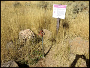
There are no ruins remaining here but this is where an old lumber mill processed the giant ponderosas for the frame of the St. George LDS Temple. The sounds of the steam-powered lumber mill would have rumbled in this valley, punctuated by the screams of a blade cutting logs to size. The boards were loaded onto wagons and ox teams pulled the wagons over 80 miles back to St. George in the 1870s. Nixon Spring still produces water today. It is now capped to support the Nixon Administrative Site and fire fighting efforts. The spigot shown above at the Mt. Trumbull trailhead may have water in the summer, but the water has not been treated, so it must be boiled before drinking. We then drive back to camp. It has been much cooler today and the forecast calls for a low of 23 degrees tonight. I'm glad we are car camping and have the luxuries of a heavy duty sleeping bag and extra coats and clothing. The older gentleman we met at the Ranger station and his wife come by to check on permits and to clean the bathrooms. We compliment them on the cleanliness of the bathrooms. They indicate that they are volunteering here for three months and then returning to their home in Bend, Oregon. Tomorrow we are going to hike a little on the Tuckup Trail. MAIN INDEX | HIKING INDEX | BACK TO DAY 1 | FORWARD TO DAY 3
|