|
ALL HIKERS
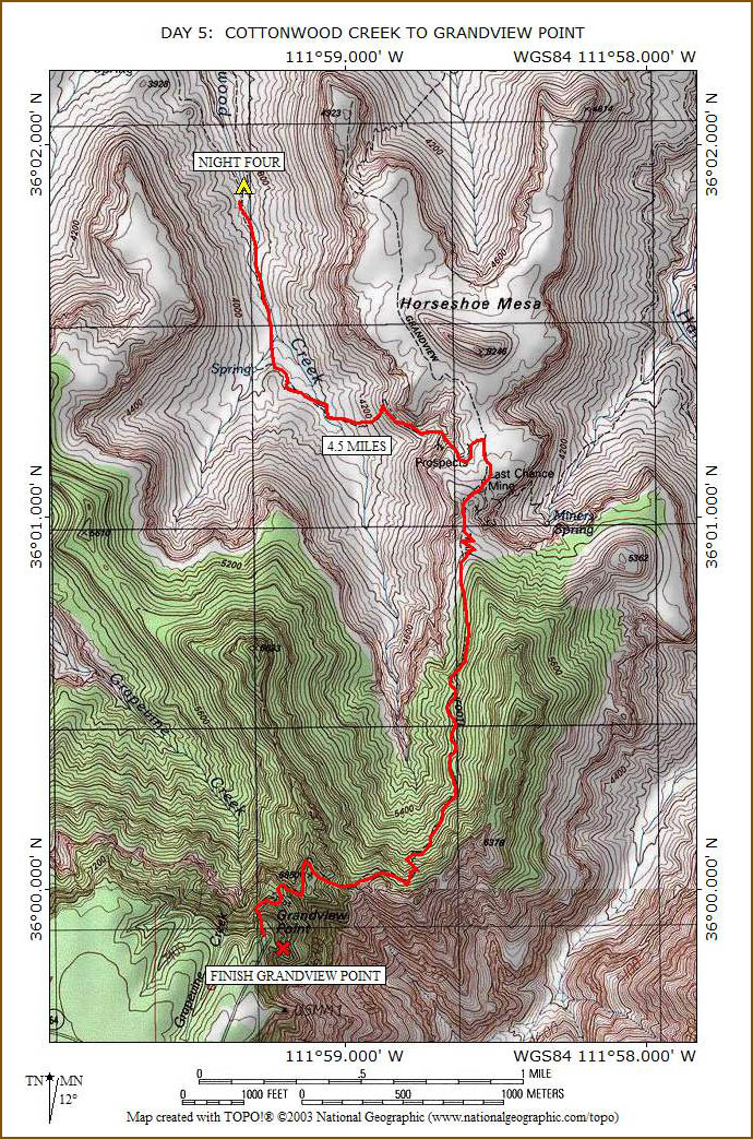
DAY 5:
COTTONWOOD CREEK TO GRANDVIEW POINT |
After breakfast with more yummy
bacon, we head south on the trail toward the west side of Horseshoe
Mesa. It is mostly level with only a slight uphill grade.
 |
 |
 |
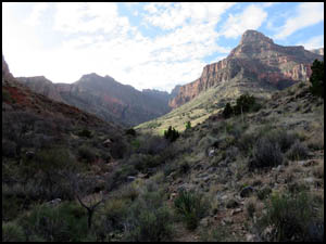
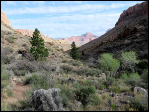
Leaving Cottonwood Creek
4-3-2018 @ 8:26 |
Leaving Cottonwood Creek
4-3-2018 @ 8:31 |
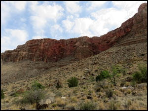
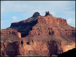
Looking up to Horseshoe Mesa
4-3-2018 @ 9:02 |
We are able to get some great pictures of
the Angels Gate across the River to the north.
 |
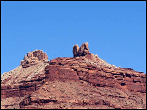 |
Angels Gate
4-3-2018 @ 8:31 |
Angels Gate
4-3-2018 @ 9:15 |
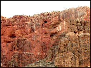
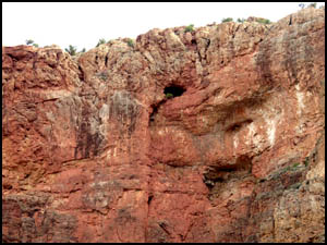
As we make our way, we attempt to locate Cave of the
Domes, which is just below the surface of Horseshoe Mesa. It is the only cave
in the Grand Canyon that you may legally enter. There is some very minor
exposure getting from Horseshoe Mesa down to the entrance.
 |
 |
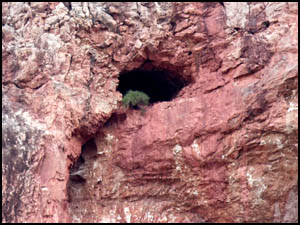 |
Cave of the Domes
4-3-2018 @ 9:02 |
Cave of the Domes
4-3-2018 @ 9:02 |
Cave of the Domes
4-3-2018 @ 9:03 |
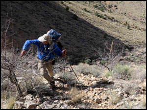
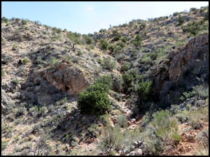
Then comes the climb up to Horseshoe
Mesa. Richard and I are right in the middle of a lengthy discussion when we
inadvertently get off the trail because we aren't paying close attention to our
hiking. I keep thinking that I will get back on the proper trail by proceeding
ahead. That results in some serious rock climbing. Geez Louise! Richard and I
are very embarrassed to have made such a rookie mistake by not immediately
backtracking to a known point on the correct trail. Wait just a minute! I can
rationalize this situation with the best of them. We did this on purpose to
refine and hone our rock climbing skills. Yeah, that's it!! That's our story
and we're sticking to it!
|
|
 |
|
|
|
Climbing off-trail
4-3-2018 @ 9:54 |
|
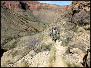
Wow! It's hard to believe you could get
off a trail as wide and distinct as this. We agree to keep this a secret just
between the two of us.
 |
 |
 |
Richard on the trail
4-3-2018 @ 9:58 |
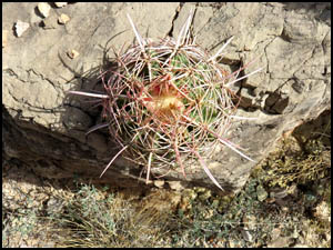
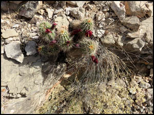
Beehive Cactus
4-3-2018 @ 9:55 |
Hedgehog Cactus
4-3-2018 @ 9:55 |
The trail now makes a few switchbacks and
gets steeper until we are very close to the top of Horseshoe Mesa.
|
|
 |
|
|
|
Almost to Horseshoe Mesa
4-3-2018 @ 10:25 |
|
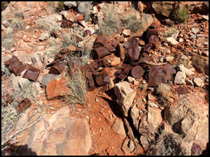
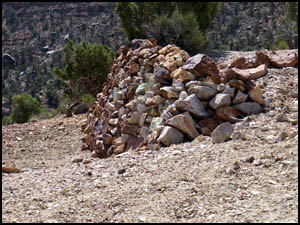
Just a few feet before reaching the Mesa,
we come across piles and piles of old tin cans. Since all mining operations
ceased on Horseshoe Mesa in 1907, these cans have to be well over a century
old. I'm surprised that they have not completely rusted away. What's more,
many of them are in excellent condition.
 |
 |
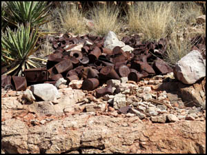 |
Old tin can pile
4-3-2018 @ 10:33 |
Old tin can pile
4-3-2018 @ 10:33 |
Old tin can pile
4-3-2018 @ 10:33 |
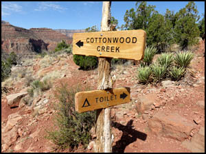
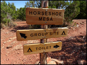
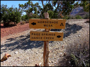
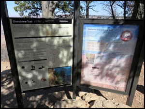
The Park Service has been busy putting up
new signs since I was here last. They are the all-wood variety. It does not
show well in the second picture below, but the top sign on that post has already
split in half between the two words. I guess that's the price you pay when you
don't use a synthetic material for the sign.
 |
 |
Sign on Horseshoe Mesa
4-3-2018 @ 10:35 |
Sign on Horseshoe Mesa
4-3-2018 @ 10:36 |
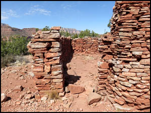
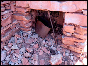
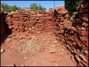
I've always thought the Cooks Cabin on
the Mesa is a pretty neat structure. The large pot in the second picture below
was in perfect condition hanging inside the fire place my first time down here.
It is now falling apart. Click
here to see two pictures of original buildings on Horseshoe Mesa taken
around 1903.
|
|
 |
|
|
|
Cooks cabin, Horseshoe Mesa
4-3-2018 @ 10:36 |
|
 |
 |
 |
Fire place in cooks cabin
4-3-2018 @ 10:36 |
Cooks cabin, Horseshoe Mesa
4-3-2018 @ 10:36 |
Cooks cabin, Horseshoe Mesa
4-3-2018 @ 10:37 |
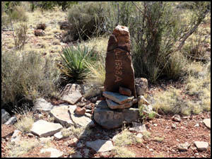
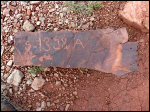
Pete Berry's original claim marker from
1892 is shown in the first picture below. On a prior hike in 2015, I found an
almost identical marker to another of his mines on the east side of the Mesa.
That marker is shown in the second picture below.
 |
 |
 |
Pete Berry claim marker
4-3-2018 @ 11:05 |
Another Pete Berry claim marker
found during a hike in 2015 |
Sign near Last Chance Mine
4-3-2018 @ 11:10 |
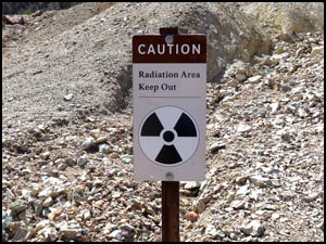
Just a little bit south of here is the
Last Chance Mine, the more famous of the Pete Berry mines. It had high grade
copper ore. The Park Service has recently posted a "radiation" and "keep out"
sign here. They used to let you go inside the mine, but the entrance to it is
now completely covered up with rocks.
 |
 |
 |
Sign near Last Chance Mine
4-3-2018 @ 11:10 |
Sign near Last Chance Mine
4-3-2018 @ 11:10 |
Last Chance Mine
4-3-2018 @ 11:11 |
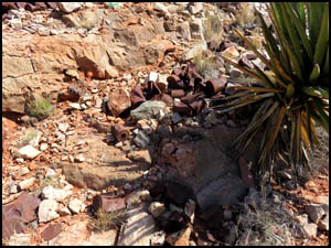
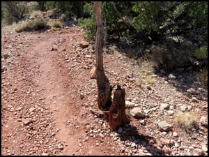
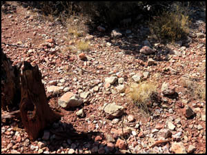
The two pictures below do not show it
well, but the first one is an old tree that has a lot of barbed wire attached
to. That wire is laying on the ground in the second picture. I wonder if this
was some kind of a toll gate that Pete Berry and Ralph Cameron used to charge
people to use their trail in the 1890s.
 |
 |
An old tree with barbed wire on it
4-3-2018 @ 11:21 |
Barbed wire on the ground
4-3-2018 @ 11:21 |
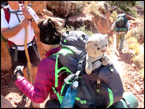
A little farther up the trail we meet a
family hiking down. This is the first time I have seen someone bringing a large
toy stuffed animal with them.
|
|
 |
|
|
|
Girl with a toy stuffed animal
4-3-2018 @ 11:46 |
|
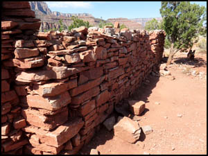
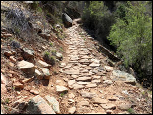
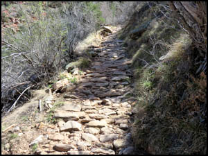
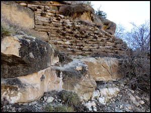
Pete Berry and Ralph Cameron went to
great lengths in 1893 to "pave" their trail from Horseshoe Mesa to Grandview
Point with stones. They needed this hard surface to accommodate their copper
mining on the mesa and to provide an all-weather surface for the numerous mule
teams carrying ore up to their mill at Grandview Point. Despite not being
maintained for over a century, many of the paved sections of the trail are still
in excellent shape.
 |
 |
Paved section of trail
4-3-2018 @ 12:43 |
Paved section of trail
4-3-2018 @ 12:52 |
About half-way to the top is a saddle
area where I take a break. Richard is already here waiting in the shade. As
slow as I am uphill, he probably has been here a long time. There are very nice
views to the east from here.
|
|
 |
|
|
|
Saddle point half-way up
4-3-2018 @ 1:40 |
|
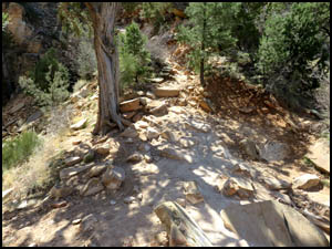
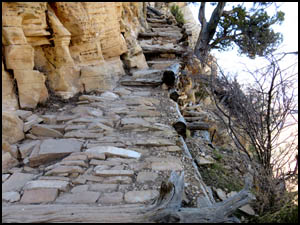
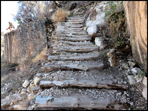
A few years ago several of the upper
sections of the trail sustained a lot of damage and collapsed after heavy
rains. The Park Service went to great lengths during their restoration process
to maintain an "all natural" look. Hence, their repairs were made entirely
using cedar and juniper trees.
 |
 |
 |
A repaired section of the trail
4-3-2018 @ 2:19 |
A repaired section of the trail
4-3-2018 @ 2:46 |
A repaired section of the trail
4-3-2018 @ 2:49 |
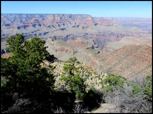
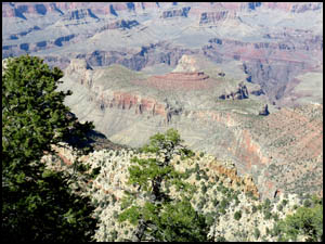
Just before reaching the top, I get
several pictures of Horseshoe Mesa below. It's easy to see why this place is
named Grandview Point.
 |
 |
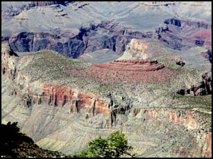 |
Horseshoe Mesa from near the top
4-3-2018 @ 3:01 |
Horseshoe Mesa from near the top
4-3-2018 @ 3:01 |
Horseshoe Mesa from near the top
4-3-2018 @ 3:02 |
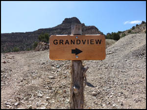
I find Richard at the top when I arrive.
|
|
 |
|
|
|
Grandview Point trailhead sign
4-3-2018 @ 3:04 |
|
We pile our stuff into my car, drive to
the Backcountry Office to pick up Richard's car, and head to Wendy's in Tusayan
for lunch. Then I start the drive back to Oklahoma and Richard heads for
Louisiana.
MAIN INDEX
|
HIKING INDEX
|
BACK TO
DAY 4 |
FORWARD TO POSTSCRIPT
|
Copyright © Richard M. Perry, 2004-2024. All rights reserved. This web site, its text, and pictures may
not be copied without the express written consent of Richard M. Perry. |
|