|
ALL HIKERS
DAY 2:
THE LITTLE COLORADO RIVER TO THE CONFLUENCE |

Although no where near one hundred
percent, I'm felling much better this morning. Jonathan and Pete are
going to do a side hike a half-mile or so upstream to a feature called the
"Emerald Pools." They leave their heavy gear here and strike out with
only daypacks. Richard and I are having none of that. He and I
eventually leave camp around 8:30 and make our way back to the helipad.
We have heard that the Tamarisks and Acacia are very dense the first few
hundred yards and that the going will be slow.
| |
 |
|
| |
Leaving the helipad
10-14-2016 @ 8:31 |
|
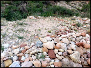
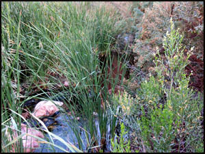
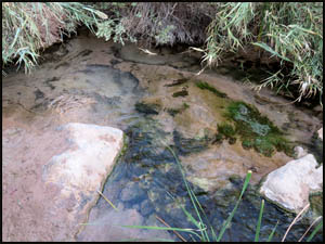
Right away we
find a clear running stream well above the level of the Little Colorado.
This must be runoff from underground water coming down Salt Trail Canyon.
Last night I filtered water from a standing pool of clear water the other
side of the helipad, but I wish I had known about this flowing water.
The water filtered from the standing pool tasted awful, but maybe the
flowing water would have fewer minerals in it and taste better.
 |
 |
 |
Clear flowing water
10-14-2016 @ 8:40 |
Clear flowing water
10-14-2016 @ 8:40 |
Clear flowing water
10-14-2016 @ 8:40 |
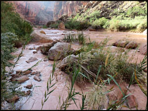
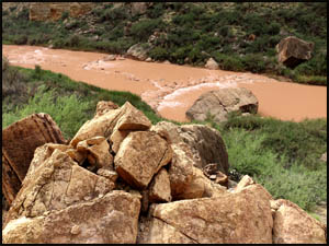
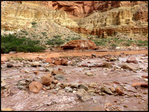
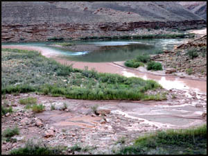
We had hoped
the LCR would be flowing clear, but it is still slightly muddy. The
stories of thick Tammies and Acacia near the helipad were all true.
This is no fun at all.
 |
 |
 |
A muddy Little Colorado River
10-14-2016 @ 8:43 |
Thick Tamarisks
10-14-2016 @ 8:51 |
Tough going in thick brush
10-14-2016 @ 9:07 |
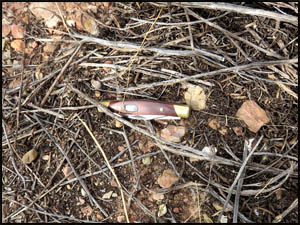
The going has
been pretty tough, so after an hour of hiking, Richard and I take a break.
While sitting, a couple of items fall out of my pant's pocket. I pick
them up, but realize my favorite Buck knife is missing. This side
pocket on my pants has a flap with only one very small Velcro fastener in
the middle to keep it closed. It easily allows stuff to fall out when
sitting. I've got to remember to sew Velcro across the entire flap
when I get home. I look around a little and luck is with me. A
few feet away I find my knife on the ground.
| |
 |
|
| |
My lost pocket knife
10-14-2016 @ 9:37 |
|
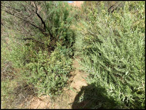
An hour and a
half after leaving this morning, we estimate that we have gone less than a
half-mile. However, it looks like the hiking is going to get easier
once we get past this last mound of big rocks. The Tamarisks thin out
and the going indeed gets much better.
 |
 |
 |
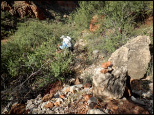
Scrambling around rocks
10-14-2016 @ 10:02 |
Scrambling around rocks
10-14-2016 @ 10:02 |
Easier going
10-14-2016 @ 10:15 |
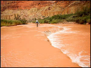
In just a
little while, we reach a good place to cross the Little Colorado River.
The Park Service recommends crossing just up stream and as close as
possible to one of the travertine dams. Apparently, the sediment build-up behind the travertine dams makes for a shallower water depth. The
other guys indicated they were crossing with their boots on, but I take my
boots and socks off and put on my Crocs. I did not want to hike later
with wet boots and socks. Richard does take his socks off, so at least
those will be dry on the other side. I was a little concerned that my
footing would be slippery with Crocs, but I have no problem maintaining my
footing. Near the far side where the travertine dam ends, Richard and
I hold hands in the deeper water to increase our stability. This works
well and we safely reach the far bank, but I would not want to do this
crossing in any deeper water.
 |
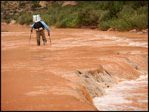 |
Richard crossing the LCR
10-14-2016 @ 10:39 |
Richard crossing the LCR
10-14-2016 @ 10:39 |
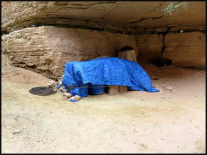
We sit down
and dry off our feet. While Richard puts on wet boots, I have the
luxury of dry ones. We come across some covered materials that must be
associated with the Humpback Chub project.
| |
 |
|
| |
Covered materials
10-14-2016 @ 11:26 |
|
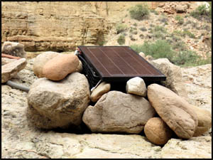
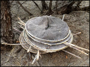
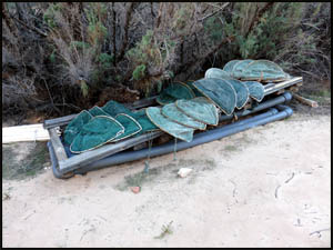
We then find
a solar panel on top a boulder and some fish baskets nearby, probably more
Humpback Chub stuff.
 |
 |
 |
A solar panel
10-14-2016 @ 11:32 |
A solar panel
10-14-2016 @ 11:32 |
Fish baskets
10-14-2016 @ 11:33 |
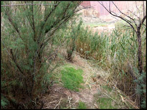
Someone has
had some kind of a brush-hog down here because the trail goes right through
thick canes that would be pretty tough to get through if a path through them
had not been cut recently.
| |
 |
|
| |
A path through thick canes
10-14-2016 @ 11:46 |
|
We eventually
see the Sipapu on the other side of the LCR. This is a large rock
mound with a hole down the middle and bubbling water below. Sipapu is
a Hopi word which refers to a small hole or indentation. This is one
of the Hopi Tribe's most sacred spots. The Sipapu symbolizes the
portal through which their ancient ancestors first emerged to enter the
present world. They believe it is from this point that the "First Peoples" of the
Earth began to divide and separate, creating differing tribes along the
first journeys of the first humans.
 |
 |
 |
Hopi Sipapu
10-14-2016 @ 12:37 |
Hopi Sipapu
10-14-2016 @ 12:40 |
Hopi Sipapu
10-14-2016 @ 12:40 |
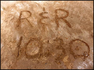
In a few
minutes, the trail takes us across a flat section of sand. Since I am
a prankster at heart, I'm going to leave a fake message in the sand for
Jonathan and Pete. My motto has always been, "why tell a little white
lie when you can tell a real whopper." Instead of the time in my
message being an hour early, I'll just make it two hours early.
Richard and I practice our story, so we can sound believable at camp when
they are sure to ask us if this was our real time here. I learn later
that Richard caved after the first question from Jonathan and Pete and
immediately 'fessed up. Geez Louise, I've really got to counsel him
about learning to lie better.
| |
 |
|
| |
A message for Jonathan and Pete
10-14-2016 @ 12:47 |
|
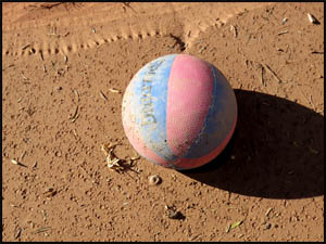
Later this
afternoon we come across a toy rubber ball about half the size of a regular
basketball. A littler earlier we actually saw a real basketball in the
sand, but I forgot to get a picture of it. Apparently, the workers on
the Humpback Chub project bring these with them when they are working down
here. The hiking has been infinitely easier since passing the Sipapu
and we are making pretty good time now.
 |
 |
 |
A toy ball
10-14-2016 @ 3:08 |
A toy ball
10-14-2016 @ 3:08 |
An easy walking stretch
10-14-2016 @ 3:54 |
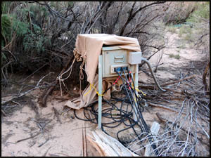
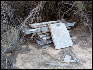
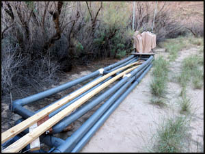
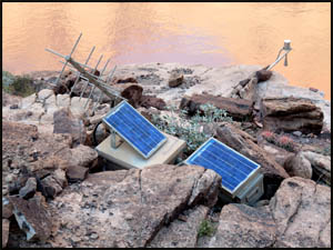
The next
monitoring station we come to has quite a bit of equipment and supplies in
it. That box in the first picture has several large cables plugged
into it that run out into the LCR. Apparently, the numerous solar
panels in the last picture supply electricity to the box. I wonder
what all they are monitoring here. My guesses would be LCR depth,
temperature, and flow rate.
 |
 |
Monitoring station equipment
10-14-2016 @ 4:00 |
Monitoring station equipment
10-14-2016 @ 4:00 |
 |
 |
 |
Fish nets
10-14-2016 @ 4:00 |
Monitoring station equipment
10-14-2016 @ 4:01 |
Monitoring station equipment
10-14-2016 @ 4:01 |
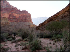
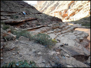
We climb up
onto some ledges, which provide very easy walking. We have to be
getting close to the Confluence.
| |
 |
|
| |
Getting close to the Confluence
10-14-2016 @ 4:14 |
|
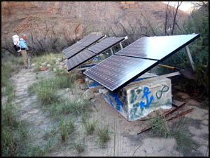
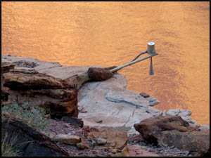
This next
monitoring station has what appears in the first picture to be some kind of
sonar. I wonder what that antenna in the second picture does.
Maybe it transmits data someplace.
 |
 |
Another monitoring station
10-14-2016 @ 4:24 |
Another monitoring station
10-14-2016 @ 4:25 |
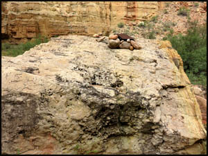
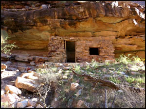
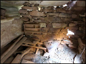
We are
trudging along with our heads down and almost walk right past Ben Beamer's cabin.
It would have taken a tough person to live alone in this remote spot.
Beamer is one of the few historic Canyon people for whom there is no known
picture.
 |
 |
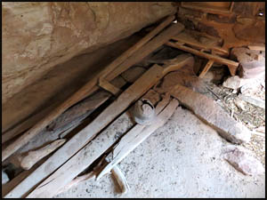 |
Ben Beamer cabin
10-14-2016 @ 4:44 |
Ben Beamer cabin
10-14-2016 @ 4:55 |
Ben Beamer cabin
10-14-2016 @ 4:55 |
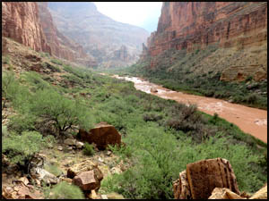
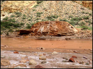
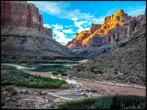
We
finally reach the Confluence, which is the intersection of the Colorado
River and the Little Colorado River. It has been
over a week since the last rain. The Colorado River is flowing a
pretty green color while the Little Colorado River is in the last stages of
a muddy flow. Many people do not know that it is usually the LCR that
makes the Colorado River below the Confluence muddy. We are hoping
there will not be much silt in the Colorado River water at our campsite about a
quarter-mile downstream from here. That would make filtering much
easier.
 |
 |
 |
The Confluence
10-14-2016 @ 5:08 |
The Confluence
10-14-2016 @ 5:08 |
The Confluence
10-14-2016 @ 5:08 |
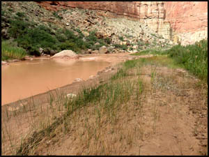
We round the
corner, make our way downstream a short distance, and take the trail down to
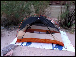
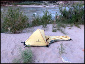
the camping area. After setting up camp, we fix dinner. I am
lucky I got to feeling better as the day went along. The River water
turned out to have no silt in it, making filtering easy.
 |
 |
Richard's tent at camp near the Confluence
10-14-2016 @ 6:04 |
Richard Erbe's bivy at camp
10-14-2016 @ 6:05 |
Surprisingly,
Jonathan and Pete pull into camp just as it's getting dark. I expected
their arrival to be much later than this. Tomorrow we are moving camp
downstream to Palisades Creek.
MAIN INDEX
|
HIKING INDEX
|
BACK TO
DAY 1 |
FORWARD TO DAY
3
|
Copyright © Richard M. Perry, 2004-2025. All rights reserved. This web site, its text, and pictures may
not be copied without the express written consent of Richard M. Perry. |
|