|
ALL HIKERS
DAY 3:
HANCE RAPIDS TO CARDENAS CREEK |
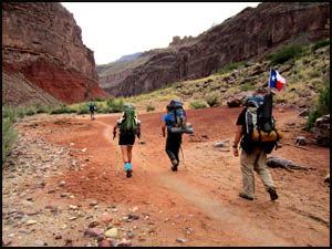
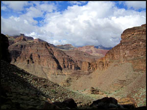
There was not much rain last night, which was a refreshing change from the
previous night. We get around and head for Hance Rapids. It doesn't
show well in this picture below right, but there are plenty of big rocks in the River at Hance Rapids. I've done three motorized raft trips down the Colorado and
on all three, the motors or props were damaged here.
 |
 |
 |
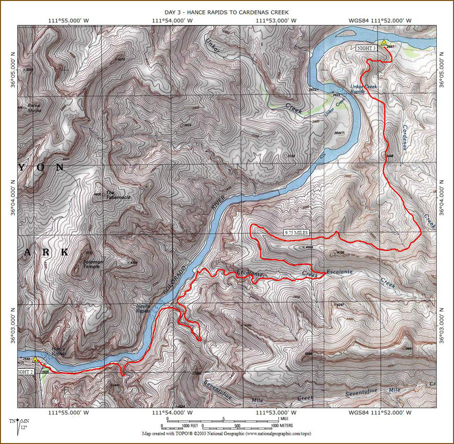
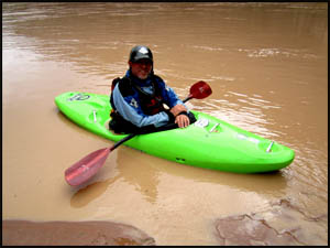
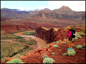
Blue Heron
10-21-2015 @ 7:59 |
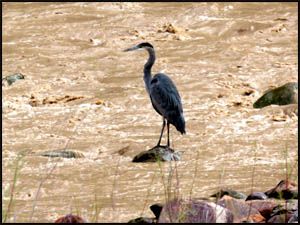
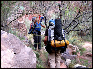
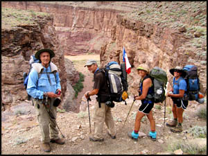
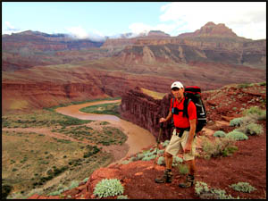
Leaving camp
10-21-2015 @ 8:07 |
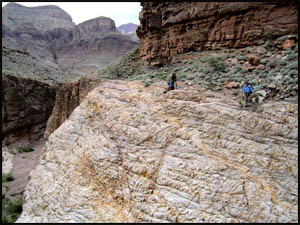
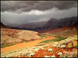
Hance Rapids
10-21-2015 @ 8:15 |
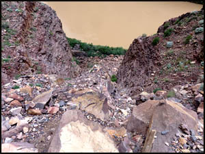
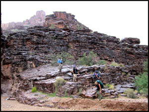
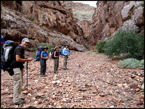
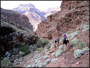
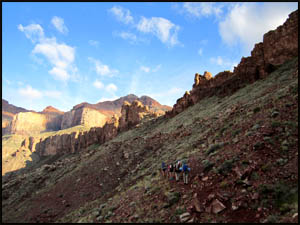
I had forgotten just how much brush and vegetation there is between the
rapids and the Papago Slide. This is a real slog with some minor
scrambling. The going is very slow and requires us to get down on all
fours a few times to crawl under low hanging tree limbs.
 |
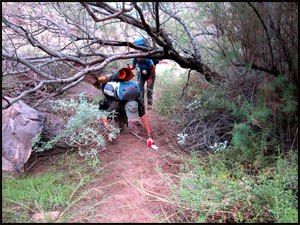 |
Heavy underbrush
10-21-2015 @ 8:21 |
Heavy underbrush
10-21-2015 @ 8:21 |
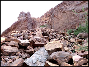
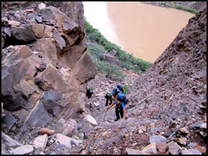
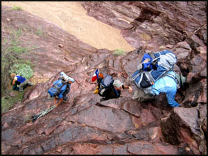
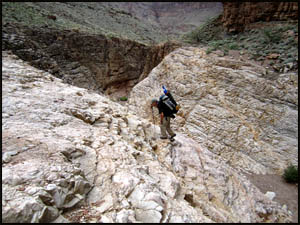
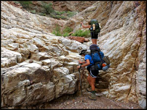
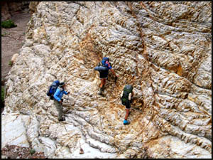
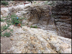
We finally reach The Papago Slide, which is a real eye-opener for those who
have not done it before. The steepness coupled with the huge boulders
make it extremely tough. We start up and reach the top in about a
half-hour. The very top section seemed easier than my first time this
way. Maybe the correct path at the top has been established better
over time.
 |
 |
The Papago Slide
10-21-2015 @ 8:57 |
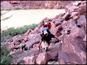
Climbing the Slide
10-21-2015 @ 9:07 |
 |
 |
 |
Climbing the Slide
10-21-2015 @ 9:13 |
Climbing the Slide
10-21-2015 @ 9:20 |
On top the Slide
10-21-2015 @ 9:24 |
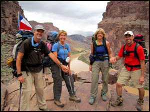
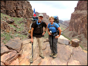
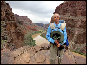
Safely at the top, it's time to get a few pictures of everyone with Hance
Rapids in the distance.
| |
 |
|
| |
Craig, Traci, Emily, and Adrian
10-21-2015 @ 9:26 |
|
 |
 |
 |
Emily and Adrian
10-21-2015 @ 9:26 |
Craig and Traci
10-21-2015 @ 9:27 |
Richard
10-21-2015 @ 9:28 |
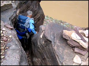
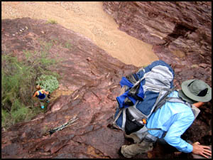
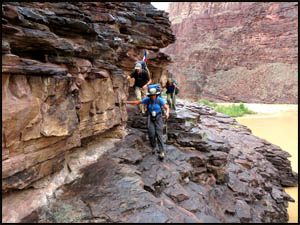
Having made it to the top of the Slide, it's time to descend the Papago
Wall. We make our way down through a crevice in the rocks and go over
to the top of the Wall. Descending the Wall is tougher than climbing
up it because you have a harder time seeing your hand and footholds.
Just as we are getting ready to start down, the rain starts. This
makes our descent even more difficult as the rocks will now be slick. My
first time this way I roped my pack down. However, with the number of
hikers we have to help out, I think we can do it today with our packs on.
Adrian gives me a hand while I climb down about six feet to the first
natural standing point. Adrian and I together then help the others
down to this point. From here, I help everyone to reach the next spot below.
The remainder of the descent from that point is easier. We ferry all the
hiking poles to the bottom.
 |
 |
 |
Richard starting down
10-21-2015 @ 9:33 |
Climbing down the Wall
10-21-2015 @ 9:55 |
Climbing down the Wall
10-21-2015 @ 9:56 |
After reaching the bottom, we get our
poles and start toward Neville Rapids. On all my other hikes, I went
by the "High Route" between here and there, but today we are going to try
the "Low Route," which closely hugs the water line over to a sand beach.
 |
 |
At the base of the Wall
10-21-2015 @ 10:01 |
Beginning the "Low Route"
10-21-2015 @ 10:11 |
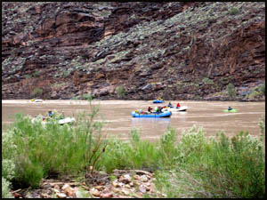
A raft group is approaching the Papago Wall and Slide as we hike by.
I've now passed the Slide and Wall five times, but only had to climb over it
twice east bound. The other three times I was west bound and hitched a
raft ride past those two obstacles.
 |
 |
Rafters near the Papago Wall and Slide
10-21-2015 @ 10:05 |
A rafter near the Papago Wall and Slide
10-21-2015 @ 10:13 |
We find the "Low Route" much easier
than the "High Route" and soon reach the sand beach near Neville Rapids and
75-Mile Creek where we take a short break. Then it's a long walk up
the 75-Mile Creek bed. Along the way, we find some interesting
volcanic rock.
 |
 |
 |
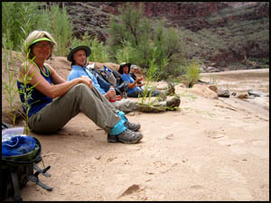
A short break
10-21-2015 @ 10:44 |
Starting up 75-Mile Creek
10-21-2015 @ 11:04 |
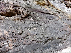
A volcanic rock deposit
10-21-2015 @ 11:06 |
At the upper end of 75-Mile Creek,
there is a little scrambling required to get out of the creek bed and up to
the trail.
 |
 |
Craig climbing out of 75-Mile Creek
10-21-2015 @ 11:29 |
Climbing out of 75-Mile Creek
10-21-2015 @ 11:33 |
 |
 |
 |
Climbing up the end
10-21-2015 @ 11:36 |
Climbing up the end
10-21-2015 @ 11:38 |
Climbing up the end
10-21-2015 @ 11:38 |
A few minutes down the trail we stop
to look over into 75-Mile Creek. There is a "shortcut" way down from
the main trail to the creek bed a few minutes before the north end. On
a previous hike, I timed how long it took me to go from the shortcut to the
north end of the main trail. It was only four minutes and the shortcut
involves a steep climb down and some exposure. It makes absolutely no
sense to me why anyone would take the shortcut. We take our lunch
break on the beach near Escalante Creek.
 |
 |
Looking down 75-Mile Creek
10-21-2015 @ 11:57 |
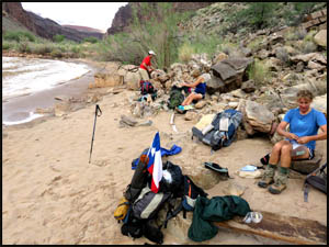
Lunch break
10-21-2015 @ 12:44 |
After lunch, we start up Escalante
Creek. Unfortunately, it is completely uphill for a couple of miles.
 |
 |
 |
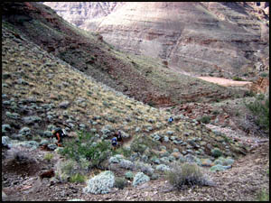
Hiking up Escalante Creek
10-21-2015 @ 1:07 |
Hiking up Escalante Creek
10-21-2015 @ 1:16 |
Hiking up Escalante Creek
10-21-2015 @ 1:53 |
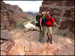
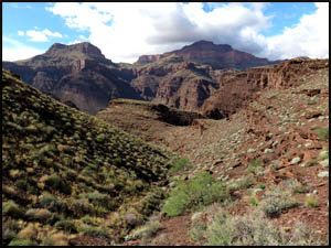
I am considerably slower uphill than
the others, so they soon leave me far behind. The upper section of
Escalante Creek is quite pretty.
| |
 |
|
| |
Looking down Escalante Creek
10-21-2015 @ 2:06 |
|
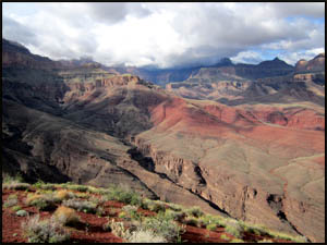
I eventually pull into the highest spot on this section where the others
are taking a break. The views from here are to die for. They are
easily the best of the entire hike. Looking west, one can see
the Papago Wall and Slide we passed this morning and looking to the east is
the Unkar Delta.
 |
 |
 |
Looking west to Papago Creek
10-21-2015 @ 2:48 |
Looking north
10-21-2015 @ 2:49 |
Looking toward the Unkar Delta
10-21-2015 @ 2:49 |
After our break, we start the long
traverse from the high point over to the northern leg of the trail.
Along the way, we see a beautiful rainbow in the distance. Maybe this
is a sign that all the rain is finally over.
 |
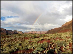 |
On the traverse
10-21-2015 @ 4:03 |
Rainbow
10-21-2015 @ 5:00 |
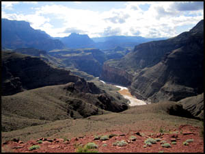
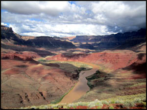
After reaching the next leg, we turn north. This section of the trail
is substantially flat and pretty easy, which is a good thing because Craig,
Traci, and I are tired. This has been a long, hard day. However,
Emily and Adrian keep up a fast pace and get out ahead of us. They
stop briefly for some pictures above the River and the Unkar Delta.
 |
 |
Emily above the Unkar Delta
10-21-2015 @ 5:13 |
Adrian above the Unkar Delta
10-21-2015 @ 5:14 |
There is a nasty looking storm over by Tanner Rapids that appears to be
headed this way. Craig and Traci have not seen the Hilltop Ruins, so I
want to show it to them before that bad weather gets here I have seen
the ruins several times, but have never approached them from this side.
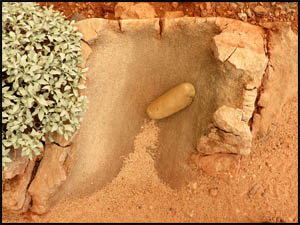
After exiting the main trail and taking a small side trail east toward the ruins,
we come across a Metate, a base stone used for grinding grain and seeds.
This is a great find and it is in excellent condition. The round,
smooth stone on top the Metate used in the grinding process is still there.
We head for the ruins just as the wind becomes strong and gusty.
I'm putting on my rain jacket right now as this looks like we're getting
rain pretty soon.
 |
 |
Ugly weather just to the east
10-21-2015 @ 5:30 |
Metate and grinding stone
10-21-2015 @ 5:35 |
 |
 |
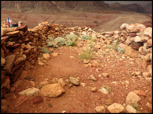 |
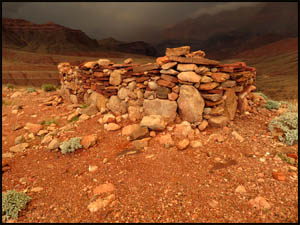
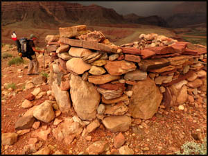
The Hilltop Ruins
10-21-2015 @ 5:37 |
The Hilltop Ruins
10-21-2015 @ 5:37 |
The Hilltop Ruins
10-21-2015 @ 5:37 |
We quickly view the ruins and then
sprint downhill as fast as possible into the campsites at Cardenas Creek.
After finding a nice protected site near the River, I help Traci and Craig
get their tents up. Just then the rain starts pouring. Once on a
prior hike I got my tent part way up without the fly on when rain came,
causing a lot of water to get inside my tent. I'm not going to have
that happen here, so I'll just stand under a tree until the rain lets up
some. After about fifteen minutes of solid rain, I've had enough and
solicit Craig's help. Reversing the order of how I normally set up my
tent, we first put the fly on my poles. We then reach under the fly
and put the main tent body on. While a little unorthodox, this
procedure keeps the inside of my tent dry. I stick in my stove and
evening meal and climb inside. After heating water, I have a good
evening meal, all nice and dry inside my tent. With all the rain, I'm
not sure the others get much to eat tonight. It absolutely pours rain
all night long. Tomorrow is a short day with only about three miles to
go over to Tanner Rapids.
MAIN INDEX
|
HIKING INDEX
|
BACK TO
DAY 2 |
FORWARD TO DAY
4
|
Copyright © Richard M. Perry, 2004-2024. All rights reserved. This web site, its text, and pictures may
not be copied without the express written consent of Richard M. Perry. |
|