|
ALL HIKERS
DAY 2: MILE
23.5 TO MILE 61, ABOVE LCR CAMP |
The morning routine begins around 5:15
with Tom's call for coffee.
Our crew fixes a great breakfast of blueberry pancakes, bacon, cantaloupe,
and honeydew melon.
For roughing in on the beach, it doesn't get much better than this.
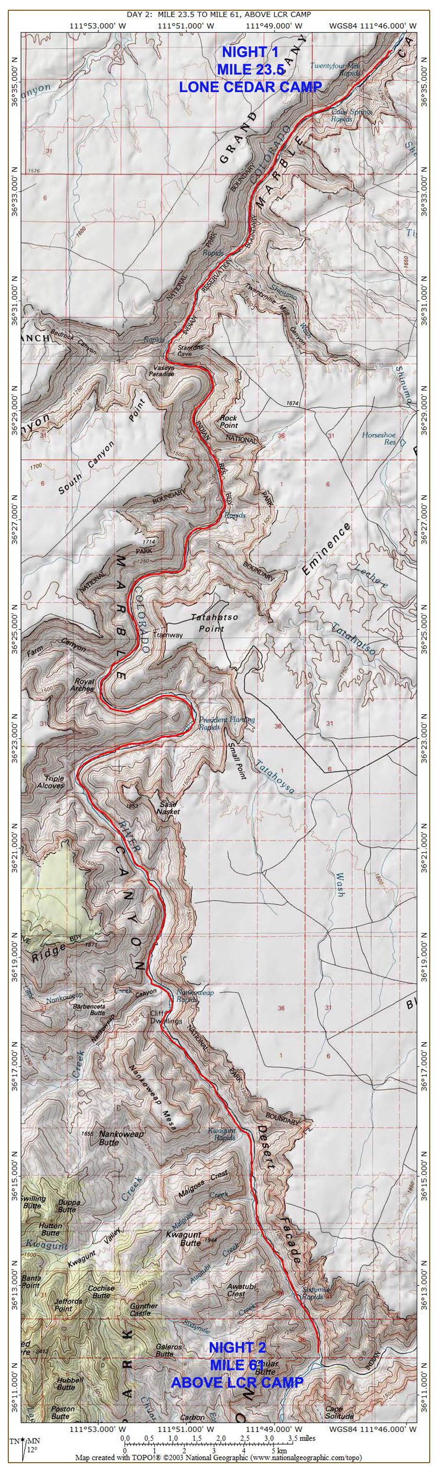
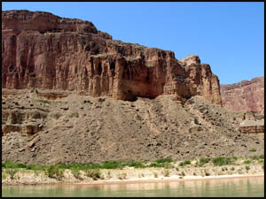
The plan each day is to leave by 7:30. Near our campsite is Stanton's Cave, named for Robert B.
Stanton, leader of Frank M. Brown's ill-fated 1889 railroad survey project.
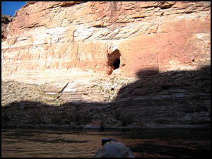
Next to it is Vasey's Paradise, a water source that gushes out of the Redwall,
named by John Wesley Powell
for his botanist friend, George Vasey, who accompanied Powell on his first trip through the
Canyon.
 |
 |
Stanton's Cave
4-29-2012 @ 8:40 |
Vasey's Paradise
4-29-2012 @ 8:42 |
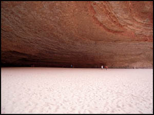
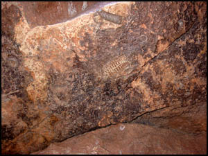
Our first stop of the day at mile 33 is the Redwall Cavern, an opening discovered by John Wesley Powell
on his 1869 expedition through the Canyon.
It is huge and has some fossils on a rock at the west side.
 |
 |
 |
Redwall Cavern
4-29-2012 @ 8:53 |
Redwall Cavern
4-29-2012 @ 8:54 |
Fossils at Redwall Cavern
4-29-2012 @ 8:56 |
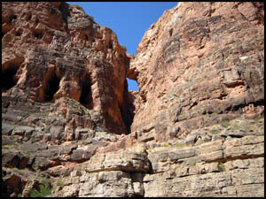
Traci is interested in seeing Bridge of Sighs, which we pass at mile 36.
| |
 |
|
| |
Bridge of Sighs
4-29-2012 @ 9:44 |
|
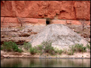
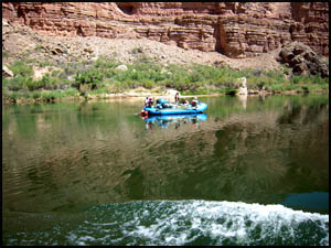
We later float by a core drilling at mile 40 for what was to be one of two dams in the
Grand Canyon. The Sierra Club brought suit and eventually stopped the
project in 1968. We pass one of many oar rafts today.
 |
 |
Abandoned dam project
4-29-2012 @ 10:36 |
An oar raft
4-29-2012 @ 10:52 |
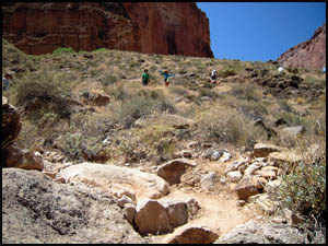
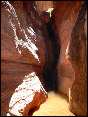
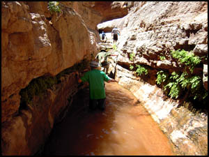
Our first day hike is up Saddle Canyon at mile 47. It's a fairly
strenuous hike, requiring a little wading to reach the small waterfall at
the end. Back at the beach, lunch is great. Today's menu is
chicken salad on tortillas.
 |
 |
 |
Climbing Saddle Canyon
4-29-2012 @ 11:41 |
Small waterfall at the end
4-29-2012 @ 12:26 |
Craig wading through water
4-29-2012 @ 12:18 |
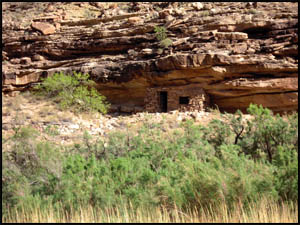
After lunch, we float by the Nankoweap granaries at mile 53. This was a winter
living area for the Anasazis over a thousand years ago. They stored
their grain in the small openings in the cliff, high above the river.
The hike here from the rim is considered one of the toughest in the Canyon.
| |
 |
|
| |
Nankoweap granaries
4-29-2012 @ 2:39 |
|
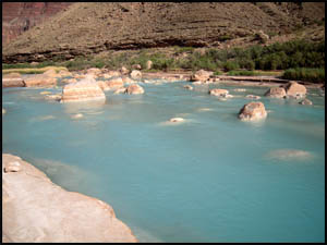
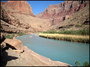
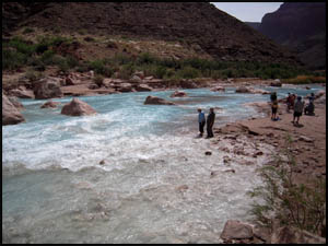
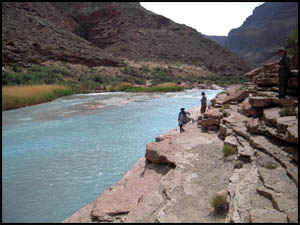
Our last stop of the day is the Little Colorado River at mile 61, often called the LCR. If there has been any
recent rain, it will be flowing a muddy, brown color, but today it is a
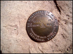
beautiful blue color. I find a Geological Survey marker, one of many I
have found in the Canyon. However, this is the first one I have seen
that did not have date, location, and elevation data stamped onto it.
The cabin used by Ben Beamer, a prospector in the late 1800s, is visible
across the Little Colorado. Several people float downstream in the Little Colorado. Unlike the
Colorado River, which is a constant forty-five degree temperature because
its water comes under the Glen Canyon Dam from the bottom of Lake Powell,
the Little Colorado is quite warm.
 |
 |
 |
Little Colorado
4-29-2012 @ 4:14 |
Ben Beamer's cabin
4-29-2012 @ 4:20 |
Little Colorado
4-29-2012 @ 4:24 |
 |
 |
 |
Little Colorado
4-29-2012 @ 4:26 |
Geological Survey marker
4-29-2012 @ 4:27 |
Little Colorado
4-29-2012 @ 4:30 |
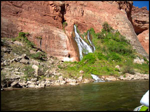
We make camp right across from the LCR at a site aptly named Above LCR Camp.
It's been a long day and I'm looking forward to consuming some adult
beverages.
 |
 |
Richard's camp spot on night two
4-29-2012 @ 5:50 |
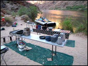
Camp on night two
4-29-2012 @ 5:50 |
Our crew
fixes us halibut, pasta, broccoli, and cherry cobbler for supper tonight. I'm wondering how they're going to
top all this great food we've had the first two days.
MAIN INDEX
|
HIKING INDEX
|
BACK TO DAY 1
|
FORWARD TO DAY 3
|
Copyright © Richard M. Perry, 2004-2024. All rights reserved. This web site, its text, and pictures may
not be copied without the express written consent of Richard M. Perry. |
|