|
ALL HIKERS
DAY 1:
GRANDVIEW POINT TO HORSESHOE MESA |
Keith and I
meet at the Grandview trailhead around 8:30, pack, and start down before
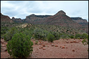
9:00. Right away Horseshoe Mesa comes into view with its
distinctive horseshoe shape.
 |
 |
Grandview trailhead sign
4-25-2012 @ 8:54 |
Horseshoe Mesa
4-25-2012 @ 8:55 |
The trail is in very good condition and we make good time.
| |
 |
|
| |
Part way down
4-25-2012 @ 9:17 |
|
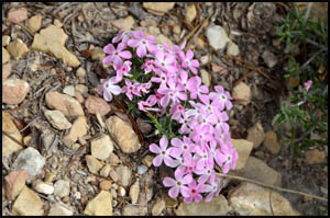
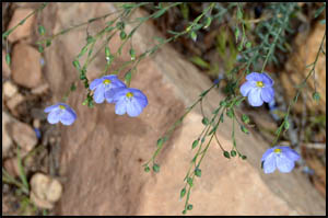
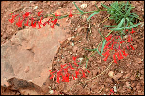
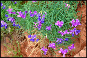
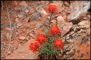
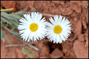
Late April is a great time in the Canyon to find lots of blooming flowers.
 |
 |
 |
Phlox
4-25-2012 @ 9:26 |
Western Blue Flax
4-25-2012 @ 9:32 |
Scarlet Penstemon
4-25-2012 @ 10:14 |
 |
 |
 |
Small-flowered Milkvetch
4-25-2012 @ 10:29 |
Indian Paintbrush
4-25-2012 @ 10:40 |
Fleabane Daisy
4-25-2012 @ 10:36 |
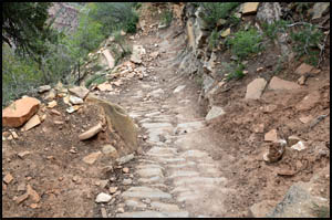
Pete Berry and
Ralph Cameron built this trail over a century ago to
facilitate access to their copper mines on Horseshoe Mesa. In order to
provide an all weather surface and to improve traction for their mule teams
carrying ore, they paved much of the trail with stones. Even after a
hundred years, many sections are still in great shape.
 |
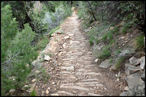 |
Stone pavers on the trail
4-25-2012 @ 9:38 |
Stone pavers on the trail
4-25-2012 @ 9:39 |
We meet two girls headed up hill on
their very first Grand Canyon hike. They picked a tough first hike by
going down the New Hance, across the Tonto to Hance Creek, and up the
Grandview.
| |
 |
|
| |
Kelly and Hillary
4-25-2012 @ 10:00 |
|
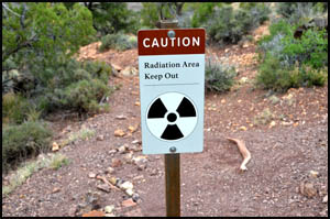
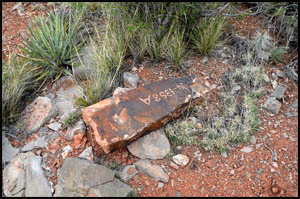
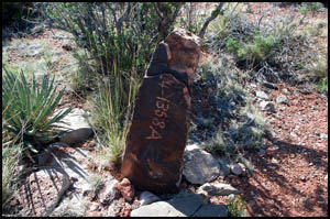
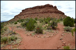
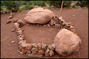
In about two hours, we reach the mesa.
This radiation sign by the Last Chance Mine is new since I was here last.
I have visited that mine opening many times in the past, but apparently the
Park Service does not want visitors to approach it now. Pete Berry's
1892 stone claim marker is lying on its side now. It was standing on
all my previous visits here as shown by a prior picture below.
 |
 |
 |
A new radiation sign
4-25-2012 @ 10:51 |
Pete Berry claim marker
4-25-2012 @ 10:56 |
Pete Berry claim marker
4-29-2009 @ 9:53 |
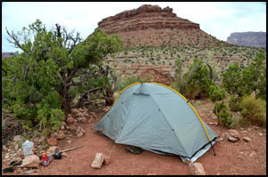
Keith and I are the only ones here, so we get our pick of campsites.
We decide to move to the far back side where the spots seem a little better
and are more isolated.
 |
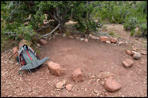 |
Horseshoe Mesa camping area
4-25-2012 @ 11:03 |
Richard's camp spot
4-25-2012 @ 11:04 |
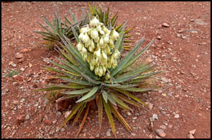
As we look over toward the butte on the mesa, we notice an opening below the
surface that appears to be a cave or mine shaft. The opening looks to
be about 10-15 feet below the surface and a near vertical downclimb.
It would probably take some rappelling skills to reach it.
 |
 |
 |
Banana Yucca
4-25-2012 @ 11:24 |
Cave - mine shaft
4-25-2012 @ 12:01 |
Cave - mine shaft
4-25-2012 @ 12:01 |
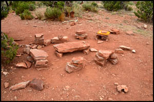
After a coin toss, I get first choice of camp spots. We set up our
tents and have a very nice kitchen and meal area with plenty of flat rocks
for cooking and sitting.
 |
 |
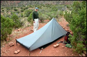 |
Richard's camp spot
4-25-2012 @ 12:09 |
Our camp meal spot
4-25-2012 @ 12:09 |
Keith's camp spot
4-25-2012 @ 12:09 |
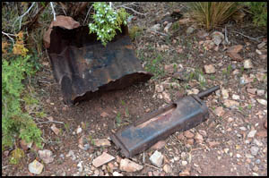
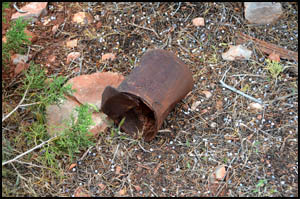
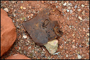
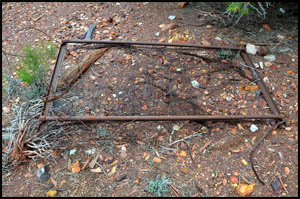
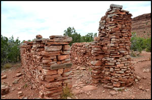
There are numerous mining artifacts and remnants left on the mesa even
though all mining activity ceased in 1907.
 |
 |
Mining artifacts
4-25-2012 @ 11:11 |
Tin can
4-25-2012 @ 12:05 |
 |
 |
 |
Tin can
4-25-2012 @ 12:11 |
Metal container
4-25-2012 @ 3:33 |
Bed frame
4-25-2012 @ 4:00 |
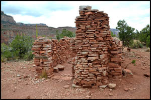
After lunch, Keith and I decide to explore some out on the northeast arm of
the mesa where neither of us has been before. On our way there, we
stop by the Cook's cabin, which has
deteriorated some since my last visit. The large cooking pot used to
be completely intact and inside the fireplace. It is now in shambles
on the floor.
Click here to see two pictures of original buildings at Horseshoe Mesa
taken around 1903.
 |
 |
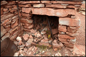 |
Cook's cabin
4-25-2012 @ 2:15 |
Cook's cabin
4-25-2012 @ 2:15 |
Cook's cabin fireplace
4-25-2012 @ 2:15 |
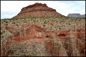
If we were going to Cave of the Domes, we would turn left at the trail split
point. We turn right and head for the group camping spot and the
northeast arm.
| |
 |
|
| |
Horseshoe Mesa butte
4-25-2012 @ 2:18 |
|
I was expecting to find the other porta-potty
near the group camping spot, but it is several hundred yards more to the
north. It seems like the Park Service has made getting to it from the
camping area kind of hard.
 |
 |
Group campsite
4-25-2012 @ 2:23 |
Group campsite
4-25-2012 @ 2:23 |
We find several blooming flowers and cactus on the mesa. Half way to
the point on the northeast arm, I decide to wait here while Keith continues
on. He reports that the view up and down Canyon from there is better
than that from the northwest arm.
 |
 |
 |
Globemallow
4-25-2012 @ 10:59 |
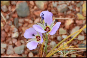
Mariposa Lily
4-25-2012 @ 3:29 |
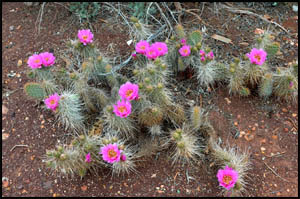
Prickly Pear Cactus
4-25-2012 @ 4:00 |
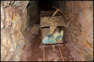
Later this afternoon, Keith and I wander over to the mine openings at the
east edge of the mesa by where the old trail used to be. The Park
Service has installed new mine gates over the shaft opening. Be poking
my camera through the bars, I am able to get a picture of a mine cart, pick
ax, and copper ore that the Park Service has arranged just inside the
opening. They have done a good job of displaying these historic items.
| |
 |
|
| |
Barricaded mine shaft
4-25-2012 @ 4:05 |
|
Keith and I
each have different agendas tomorrow. He has not done that section of
the Tonto that goes around the mesa and I have not seen the name
inscriptions down at Hance Creek. So, tomorrow morning he will head
down the west side toward Cottonwood Creek while I descend the east side
headed for Hance Creek.
MAIN INDEX
|
HIKING INDEX
|
BACK TO PREFACE
|
FORWARD TO DAY 2
|
Copyright © Richard M. Perry, 2004-2024. All rights reserved. This web site, its text, and pictures may
not be copied without the express written consent of Richard M. Perry. |
|