|
ALL HIKERS
DAY 3:
HANCE CREEK TO GRANDVIEW POINT |
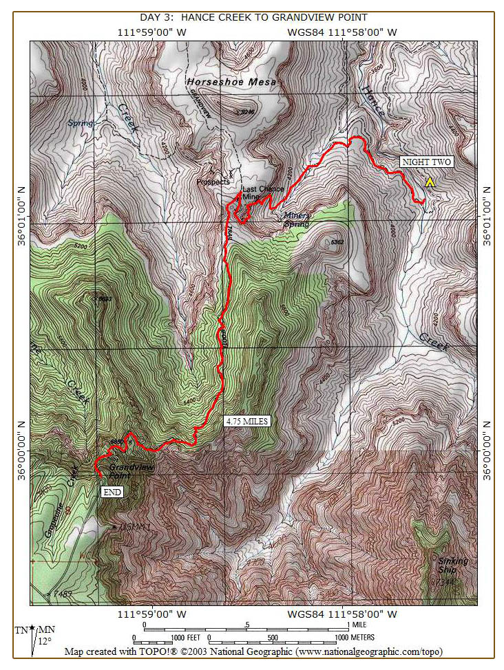
My move up
the hill to this new campsite last night worked out well. I barely
heard anything way up here and slept so well that I didn't even hear the
two guys from Ohio leave this morning. I get away from camp around
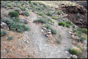
7.30 and start the steep climb up to Horseshoe Mesa. In a few
minutes, I come to the Tonto Trail junction. I take the left fork
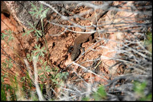
headed up to Horseshoe Mesa. A Plateau Lizard is unfazed as I walk
by.
 |
 |
Trail junction
5-1-2009 @ 7:38 |
Plateau Lizard
5-1-2009 @ 8:20 |
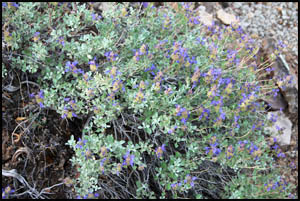
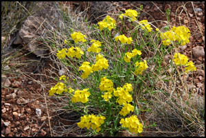
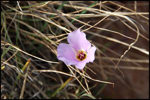
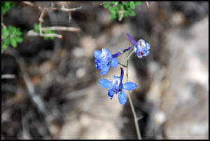
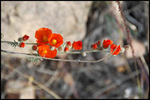
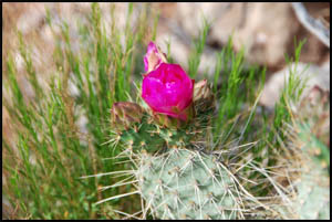
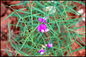
The
wonderful variety of blooming flowers continues.
 |
 |
 |
Purple Sage
5-1-2009 @ 7:35 |
Slender Janusia
5-1-2009 @ 7:51 |
Mariposa Lily
5-1-2009 @ 7:53 |
 |
 |
 |
Desert Larkspur
5-1-2009 @ 8:11 |
Globemallow
5-1-2009 @ 8:14 |
Prickly Pear Cactus
5-1-2009 @ 8:15 |
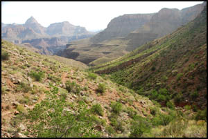
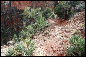
The view
looking down toward Hance Creek is quite nice.
 |
 |
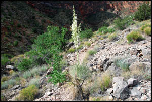
Soaptree Yucca
5-1-2009 @ 8:12 |
View down to Hance Creek
5-1-2009 @ 8:26 |
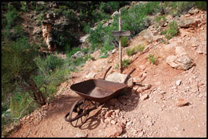
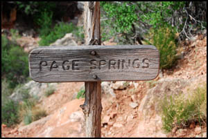
In about an
hour, I reach the trail junction for Page Springs, also called Miner's
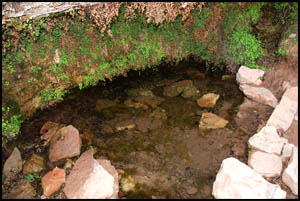
Spring. The spring is named for prospector John Page. This
old wheel barrow is neat. I drop my pack and head to the springs
to filter water for my dry camp tonight on the mesa. I am
surprised that the redbud trees near the spring are not in bloom.
They were in full bloom when I was here before, but that was about a
month earlier than this.
 |
 |
 |
Page Springs junction - wheelbarrow
5-1-2009 @ 8:33 |
Page Springs sign
5-1-2009 @ 8:33 |
Page Springs
5-1-2009 @ 8:40 |
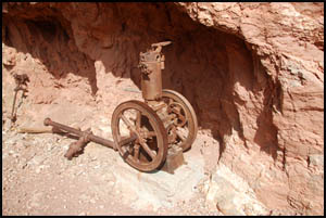
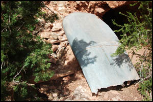
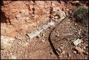
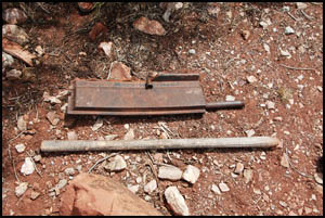
After
filtering water, I continue the steep climb. As I approach a long
debris field of tailings, I know I am near a mine. There is quite
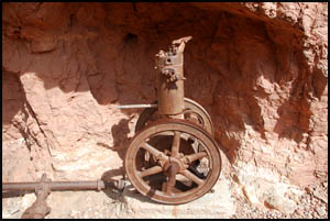
a bit of equipment at the mine entrance including a steam driven engine.
I was looking forward to exploring the mine, but there is a sign
prohibiting entering the mine. Bummer, I really wanted to look
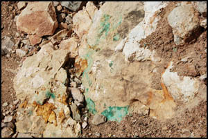
around some in there. There are lots of copper bearing rocks
laying around.
 |
 |
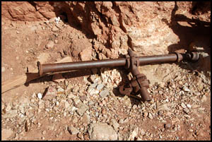 |
Steam engine
5-1-2009 @ 9:23 |
Steam engine
5-1-2009 @ 9:24 |
Drive shaft
5-1-2009 @ 9:24 |
 |
 |
 |
Mine equipment
5-1-2009 @ 9:24 |
Mine shaft
5-1-2009 @ 9:25 |
Old water tank
5-1-2009 @ 9:24 |
 |
 |
 |
Mine train rail
5-1-2009 @ 9:25 |
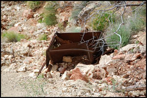
Ore bucket
5-1-2009 @ 9:26 |
Copper deposits
5-1-2009 @ 9:38 |
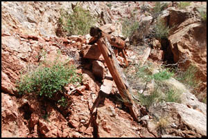
I continue the
climb to the mesa, passing many remnants of prior mining activity.
As I am taking a break at the side of the trail, I notice that there
appears to be another mine just below the cable winding device at the
top. I didn't see that my other time this way, so I think I
will explore that some this afternoon.
 |
 |
 |
Old mining artifacts
5-1-2009 @ 9:50 |
Mine timbers
5-1-2009 @ 9:51 |
Mine across the way
5-1-2009 @ 10:02 |
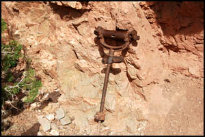
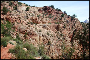
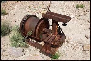
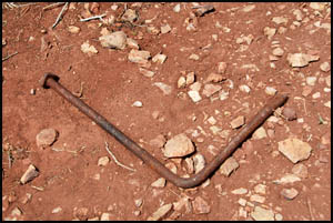
The Park
Service has done a lot of work on the upper parts of this trail as it
seems to be in pretty good shape. There are still a lot of new
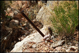
cedar logs used in trail maintenance laying around. A mule driven
cable winding device is at the very top. Maybe that's how the
miners got the copper ore to the mesa from that mine below here. I
don't recall seeing the pick and mattock by the cable winder my last
time this way.
 |
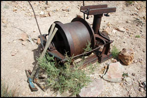 |
Cable winding device
5-1-2009 @ 10:16 |
Cable winding device
5-1-2009 @ 10:17 |
The mesa is
full of mining artifacts.
 |
 |
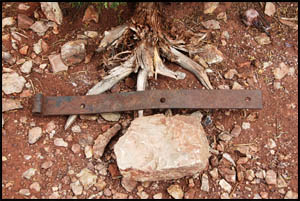 |
Mining artifacts
5-1-2009 @ 11:35 |
Mining artifacts
5-1-2009 @ 11:35 |
Mining artifacts
5-1-2009 @ 2:10 |
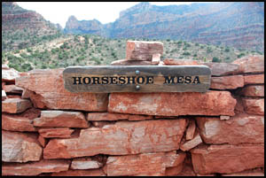
It's pretty
hot, so I think I will just nap some in the shade under a juniper tree and
wait until it cools off before I explore around the mesa. Later
this afternoon, I walk down to the cook's cabin and find the missing
Horseshoe Mesa sign on the north side of the cabin.
| |
 |
|
| |
Horseshoe Mesa sign
5-1-2009 @ 3:23 |
|
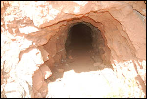
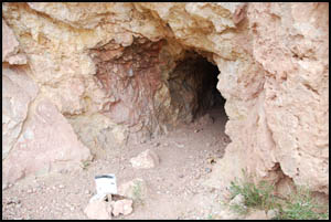
It's time
to explore that mine I saw below the cable winding machine. I
head over that way and walk down the well-traveled trail to it.
It too has a sign prohibiting entering. Another bummer. I
guess I'm zero for two when it comes to mine exploration this trip.
 |
 |
Trail down to the mine
5-1-2009 @ 3:31 |
Old mine shaft
5-1-2009 @ 3:33 |
I talk with
four guys around 4:00 who have just made it down to the mesa on their
way to Cottonwood Creek. They indicate there is a 60% chance of
rain tomorrow. I have my light-weight emergency poncho, but didn't
bring my regular rain gear with me. A front must have just passed
through as the wind has picked up and the temperature has dropped
dramatically. I really don't want to hike out tomorrow in the
rain, so I think I'll gather up my stuff and head for the rim. I
get away around 4:30. Hopefully I can make the top before dark.
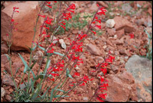
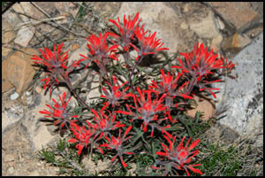
There are plenty of pretty flowers along the way.
 |
 |
 |
Scarlet Penstemon
5-1-2009 @ 5:06 |
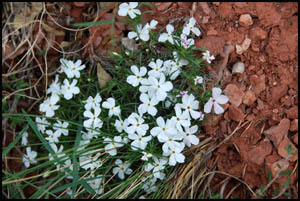
Desert Phlox
5-1-2009 @ 5:07 |
Small-Flowered Milkvetch
5-1-2009 @ 5:07 |
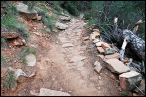
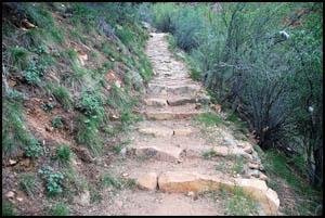
I can't
imagine the amount of effort it took for Pete Berry and Ralph Cameron to
pave this trail with stones for their mining operation. They must
have done good work because many sections appear completely intact.
 |
 |
 |
Stone paved trail
5-1-2009 @ 5:51 |
Stone paved trail
5-1-2009 @ 5:56 |
Indian Paintbrush
5-1-2009 @ 7:00 |
It is pitch
black as I near the trailhead. I'm going to plod along and hope I
don't fall off the edge, because I don't want to take off my pack and
have to fish out my headlight. Grandview Point is completely
deserted when I reach my car.
| |
 |
|
| |
Grandview trailhead sign
5-1-2009 @ 7:52 |
|
I throw my
stuff in the car and head to the Maswik for supper. Then it's to
Mather campground for the night and Flagstaff tomorrow for my second
week long raft trip through the Canyon.
MAIN INDEX
|
HIKING INDEX
|
BACK TO DAY 2
|
FORWARD TO POSTSCRIPT
|
Copyright © Richard M. Perry, 2004-2024. All rights reserved. This web site, its text, and pictures may
not be copied without the express written consent of Richard M. Perry. |
|