|
ALL HIKERS
DAY 4:
PALISADES CREEK TO TANNER RAPIDS |
Keith and I
are up at 6:30 again this morning. Around 7:30 five of Bob Bordasch's group come by headed for the Little Colorado. A little
later a solo hiker comes by going that way also. He appears to be of
Indian descent and explains he is going to search for the Hopi birthplace.
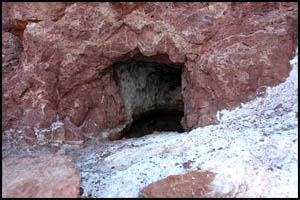
Keith and I decide to explore
Seth
Tanner's mine this morning before moving on to Tanner Rapids. The
mine is not too far from our campsite.
 |
 |
 |
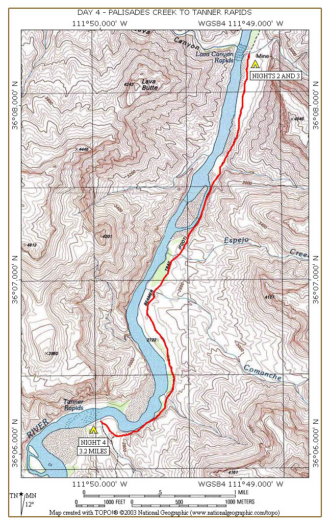
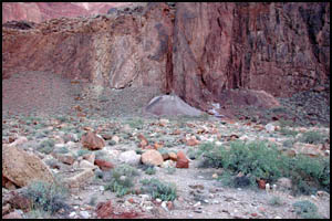
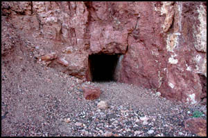
Tanner mine
10-16-2007 @ 7:50 |
Tanner mine
10-16-2007 @ 7:50 |
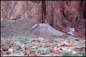
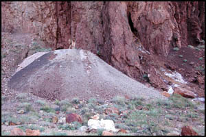
Tanner mine
10-16-2007 @ 7:52 |
We brought our headlights so we can
explore the mine shaft. This spring my daughter, son, and I explored
the Tanner Lone Star mine on the other side of the river when we did our
raft trip. Unfortunately, the floor of this mine shaft slopes up towards
the opening and there is a lot of standing water in it. It looks a
little deep, so we elect to take the few pictures we can from near the
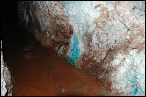
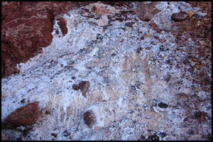
opening. The copper deposits are readily visible.
 |
 |
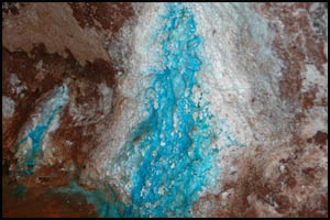 |
Tanner copper mine
10-16-2007 @ 7:54 |
Tanner copper mine
10-16-2007 @ 7:56 |
Tanner copper mine
10-16-2007 @ 7:56 |
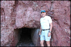
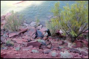
Just outside Keith and I get our picture
taken by the mine opening. I am surprised that the opening and shaft
height are so low. At only about three feet high, it would have
required a lot of stooping and crouching to work in there.
 |
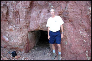 |
Keith outside first Tanner mine
10-16-2007 @ 7:59 |
Richard outside first Tanner mine
10-16-2007 @ 8:01 |
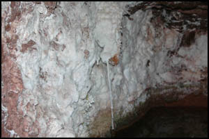
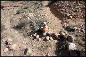
We are just getting ready to leave when
we discover a second mine shaft a little south of the first one. This
one is also filled with water. It appears this was a salt mine.
 |
 |
 |
Second Tanner mine
10-16-2007 @ 8:06 |
Second Tanner mine
10-16-2007 @ 8:06 |
Second Tanner mine
10-16-2007 @ 8:07 |
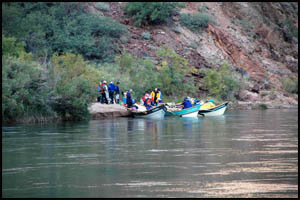
We head back to camp and begin packing our stuff. The group across the
river is doing the same thing and they soon leave.
 |
 |
Group preparing to leave
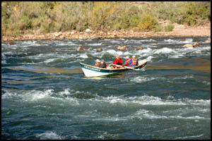
10-16-2007 @ 8:19 |
Dory running the rapids
10-16-2007 @ 8:39 |
We eventually leave around 9:30 and pass Bob's campsite, but he is nowhere to be found. In a while, we
reach the small island and the place where the high-low route decision must
be made. We decide to run an experiment: I will take the high route
and Keith will take the low route, letting us know which way is best.
 |
 |
 |
Leaving Palisades Creek
10-16-2007 @ 9:34 |
High-Low route junction
10-16-2007 @ 9:58 |
Keith on the low route
10-16-2007 @ 10:02 |
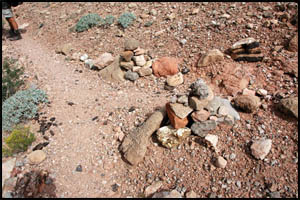
The high route climbs up a ways on a well traveled trail and then contours
in and around several drainages before descending back to the main trail.
Keith has been waiting for me at the trail junction for five minutes or so. I guess
that answers the question of which way is best. We notice that someone
has placed a small rock barrier on the high route, a barrier that wasn't
there two days ago, effectively directing hikers to the low route.
 |
 |
High-Low route junction
10-16-2007 @ 10:21 |
High-Low route junction
10-16-2007 @ 10:21 |
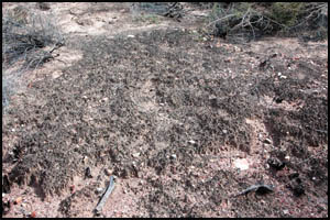
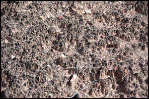
A little
later, we pass a section of
cryptobiotic soil
that you should avoid walking on.
 |
 |
Cryptobiotic soil
10-16-2007 @ 11:06 |
Cryptobiotic soil
10-16-2007 @ 11:06 |
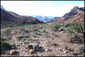
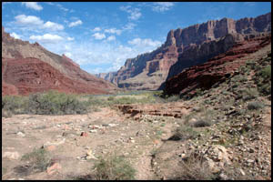
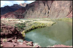
As we near Tanner Rapids, we begin the
climb up and around on the last half-mile of trail. Unfortunately,
there appears to be no way to bypass this section of the trail that goes in
and out of several drainages. We then reach the Tanner Trail junction, the place I walked right by two days ago when I wasn't paying
attention.
 |
 |
 |
Approaching Tanner Rapids
10-16-2007 @ 12:04 |
Approaching Tanner Rapids
10-16-2007 @ 12:08 |
Beamer trail junction
10-16-2007 @ 12:10 |
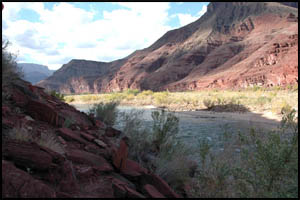
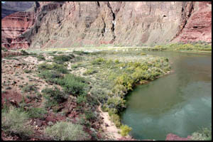
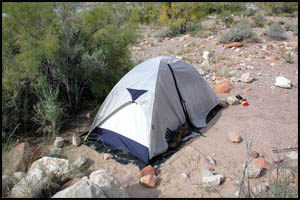
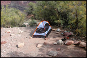
After inspecting most of the campsites
at Tanner Rapids, we take one that is only a few feet from the water.
That will make filtering water easy. Surprisingly, we don't see any
other hikers spending the night here.
 |
 |
 |
Tanner Rapids campsite
10-16-2007 @ 1:44 |
Tanner Rapids campsite
10-16-2007 @ 1:44 |
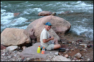
Keith filtering water
10-16-2007 @ 1:46 |
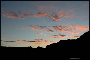
It clouds up this afternoon with a few
thundershowers nearby. It actually spits a few drops of rain on us,
but then the clouds dissipate. Sunset is only slightly better than
previous nights.
 |
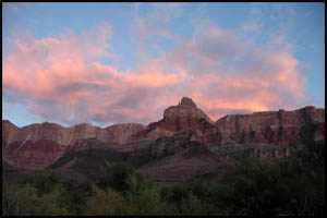 |
Fourth night sunset
10-16-2007 @ 5:51 |
Fourth night sunset
10-16-2007 @ 5:51 |
MAIN INDEX
|
HIKING INDEX
|
BACK TO DAY 3
|
FORWARD TO DAY 5
|
Copyright © Richard M. Perry, 2004-2023. All rights reserved. This web site, its text, and pictures may
not be copied without the express written consent of Richard M. Perry. |
|