|
ALL HIKERS
DAY 2:
BRIGHT ANGEL CAMPGROUND TO CLEAR CREEK |
I have the 5:30 breakfast at Phantom
Ranch, so I am up at 4:30 to begin packing. I brought my 45 degree
down sleeping bag because I thought the night time temperatures would be
moderate. However, last night I was pretty cold. I take the
lids off the metal ammo food storage cans and finish rolling up my tent
when I notice that a skunk is in the metal can raiding my food. I
start yelling at him and throwing rocks at the can. None of this
phases the skunk, although I am sure that many sleeping campers are
wondering what is going on. Eventually, I get up the nerve to take
one of my hiking poles over and start banging on the can. The skunk
moves slowly out of the can, but it takes repeated blows before he moves
off into the bushes. Geez Louise, that was close. I finish
packing and walk over to Phantom Ranch just in time for breakfast.
As with all their meals, it is great. I leave a little after six
o'clock headed up the trail. In no time at all, I reach the Clear
Creek Trail and start the long uphill climb. In about a half-hour, I
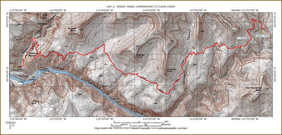
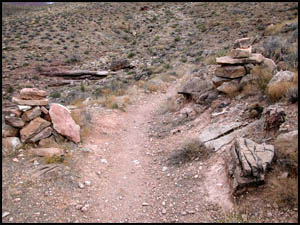
reach the Phantom Overlook. The CCC constructed the Clear Creek
Trail in the 1930s and this rock chair at the Phantom Overlook.
| |
 |
|
| |
Rock chair at Phantom
Overlook
3-9-2006 @ 7:03 |
|
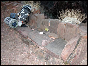
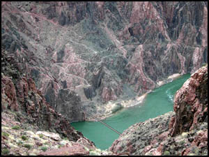
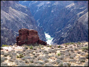
In another half-hour, I reach the top.
I am treated to a wonderful view of the Kaibab suspension bridge, the
South Kaibab Trail, and the Colorado River looking east.
|
 |
 |
|
Kaibab suspension bridge
and S. Kaibab trail
3-9-2006 @ 7:25 |
Colorado River looking
east
3-9-2006 @ 7:29 |
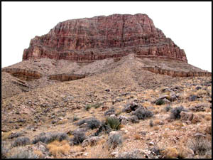
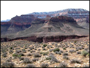
There are a few traverses around some
large drainages before I reach the cairns at Sumner Wash, which are right
below Sumner Butte. You are only allowed to camp east of the cairns.
There are a couple of nice campsites in this area. Looking toward the
South Rim, you can still see the snow from night before last.
|
 |
 |
 |
|
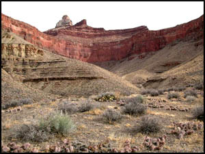
Cairns at Sumner Wash
3-9-2006 @ 8:13 |
Sumner Butte
3-9-2006 @ 8:13 |
Snow on South Rim
3-9-2006 @ 8:13 |
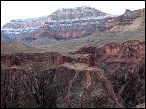
From this point on, the trail is
generally easy walking and slightly uphill. The dominant features on
the north side of the trail are Zoroaster Temple and Bradley Point.
|
 |
 |
 |
|
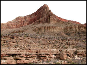
Zoroaster Temple
3-9-2006 @ 8:53 |
Bradley Point
3-9-2006 @ 9:55 |
Zoroaster Temple
3-9-2006 @ 9:59 |
I continue on the trail, passing a large drainage coming down between
Bradley Point and Demaray Point. I can see Pattie Butte on the south
side of the river together with plenty of snow at the rim. The
Colorado River is now in view at its intersection with Clear Creek. I
eventually take an extended break on the east side of Demaray Point.
|
 |
 |
 |
|
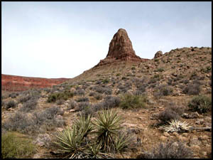
Pattie Butte on south side
3-9-2006 @ 10:34 |
Demaray Point
3-9-2006 @ 10:34 |
Colorado River
3-9-2006 @ 10:37 |
The temperature has been between 58 and 60 degrees and generally sunny.
I am a little too warm with my fleece jacket on and a little cool with it
off. My GPS has been very valuable. It shows me exactly where I
am and, unfortunately, how much farther I have to go. I am about five
hours into my hike and I am feeling good right now. There are numerous
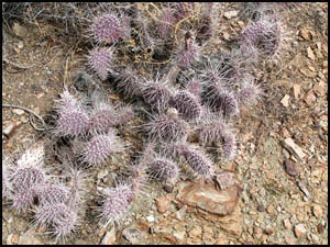
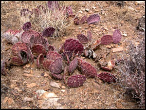
ups, downs, and small drainages to traverse for the next two hours.
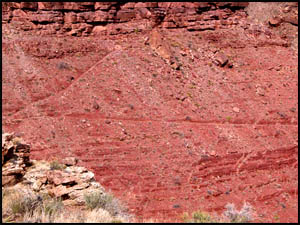
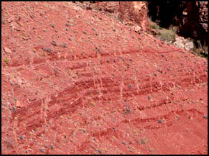
Many of the rocks, blackbrush, and cactus in this area have a strange purple
hue to them. I wonder if the soil has something in it causing that
purple tint. It's still too early for any flower or cactus blooms.
|
 |
 |
|
Cactus with purple tint
3-9-2006 @ 12:08 |
Cactus with purple tint
3-9-2006 @ 12:08 |
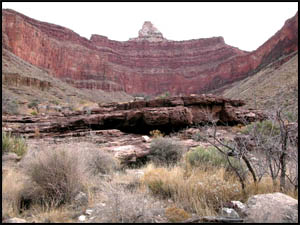
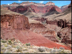
This is the final descent into Clear Creek that makes some people quite
nervous. From a distance, it is intimidating. However, when you
are actually doing the descent, it is not nearly as scary up close. The
trail is a foot or more wide and substantially level.
|
 |
 |
 |
|
Clear Creek area
3-9-2006 @ 1:16 |
Final descent
3-9-2006 @ 1:16 |
Final descent
3-9-2006 @ 1:19 |
A dry creek bed is at the bottom of the descent. A walk down the creek bed another quarter of a mile and
you come to the three campsites. It has taken me just under eight
hours to get here, pretty much on par with what other hikers report.
Much to my surprise the metal ammo food storage cans are still here.
The Park Service announced that they would start removing these January 1,
2006. I am the only one here. All the sites are next to Clear
Creek and pretty rocky, so I pick the last one on the south side. The
wind has been picking up, so I can see this will be a challenge keeping my
tent up. I place large boulders inside the rope loops at each outside
corner of my tent. Still concerned about the wind, I place a number of
rocks inside my tent at the corners and midpoints of each side. I'm
going to have to cook my food inside my tent as there is no way I could do
it outside in the wind. I wonder if the first of those two weather
fronts the Ranger talked about is starting to come through. It's
getting colder and more windy as I go to bed.
|
Copyright © Richard M. Perry, 2004-2023. All rights reserved. This web site, its text, and pictures may
not be copied without the express written consent of Richard M. Perry. |
|