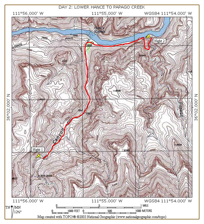
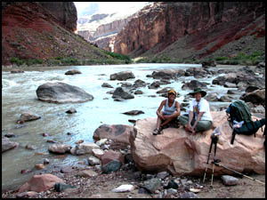
We are camped on a flat rock area just above the creek. This makes filtering water easy.
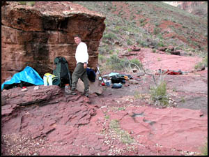
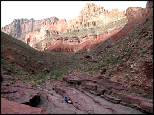
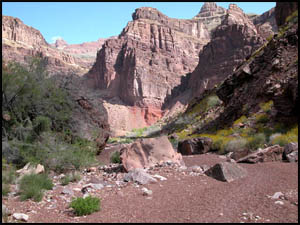
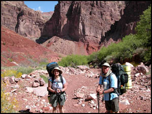
I am doing better than yesterday, but still feeling nauseous. Hance Rapids is about 1.5 miles from here. We decide to go down to the rapids, see how I am feeling there, and then make a decision on the remainder of our trip. I get all my stuff packed early and, because I will surely be slower than the others, I head north along the creek bed before Art and Marsha are ready. The creek flows above ground for several hundred yards, but then goes underground, never to be seen again. The flowers and cactus are all in bloom. Before long the creek bed turns to a pea-gravel type of material that is tiring to walk on.
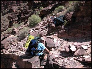
I reach an area with a six-foot drop-down right in the middle of the creek bed that is a little challenging. I later find that I missed a cairn and should have gone initially to the west side of this drop-down for an easy way around it. Then the correct trail takes you to the east side of the creek bed and climbs up above the obstructions. You guessed it, I took the west side, which was cairned, but led to a dangerous ten-foot drop-down. I successfully negotiate this second drop-down, but you would be well advised to avoid it. The correct route going toward Hance Rapids at the initial large brown boulder on the east side of the trail is an S-route: first left (west side) and then right (east side). Art and Marsha arrive just after I have made it down the dangerous area. They take the correct route both times.
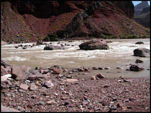
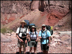
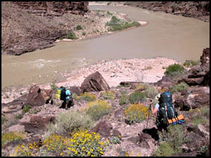
Hance Rapids is just ahead and we are ready for a break. The rapids have lots of rocks and I can see that this would be challenging for rafters. We relax and have a snack. A guide and his wife are there with a group on a day hike from their campsite above the redwall. After almost an hour, I am feeling much better and we decide to press on to the east across the Escalante Route. Our plan is to camp at Escalante Creek.
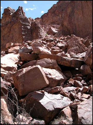
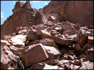
The Escalante trail is all sand leaving Hance Rapids. This is equally as tiring to walk on as the pea gravel was in the creek bed going to Hance Rapids. In three-fourths of a mile, we come to the place where the high-low route decision must be made. This is a cliff section that extends out into the river. If the river is way down, there will be enough sand exposed to allow you to walk by the cliff. The river was down for us, but not enough to allow us to pass the cliff by the low route. Marsha explains that the water discharges from the Glen Canyon Dam in recent years have not fluctuated as much as they did many years ago. We speculate that the low route will rarely, if ever, be available to pass the cliff section. The high route is indeed intimidating. I had to point my camera slightly upward to get everything to display, so the incline is actually steeper than shown in these pictures. We start up just after noon. The going is very slow and tiring.
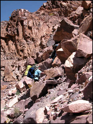
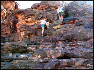
As we near the top, the trail becomes markedly steeper. I have come to a place where the trail can go upward slightly to the left or right. I take the right fork. The rocks and their good footing disappear leaving nothing but fine talus to scramble up. I suggest to Art and Marsha that they take the left fork because it has boulders on which to get a good grip, but the size of the boulders is large. We are all exhausted, scared, and a little cranky at each other at this point. I think we are each wishing we had taken the other fork (you know, the grass is greener on the other side of the fence syndrome, or in this case, the other fork is easier syndrome). We finally all make it safely to the top, but my legs and arms have sustained numerous cuts and scratches. Each fork has its own difficulties and both routes are dangerous. We proceed to the middle of the top section and take a short break. There is an 8-10 foot drop-down through a narrow crevice that requires us to lower our packs by hand. We make our way to the top of the eastern face of the cliff and have lunch. During our break, we have some frank discussions regarding our original itinerary. Marsha is hopeful this creek is Seventy-Five Mile Creek, but the GPS confirms this is Papago Creek. Marsha and I both have to be out of the Canyon in three more days. We all feel we can complete our route as planned, but not in the remaining three days. When we consider our time constraints and the poor condition Art's and my legs are in, we decide to spend two nights here and then go back up the New Hance to the rim. An additional benefit of this changed plan is that we will only be off permit our last night on the New Hance Trail.
The eastern face of the cliff section is actually steeper than the western face (almost vertical), but it has many ledges on which to get good footing. Still we are afraid to go down it with our packs on. Marsha brought some rope that we use to lower our packs down the cliff face. Finally, after almost three hours, we complete the entire cliff section. There is a wonderful sandy area at the base of the cliff where we set up camp. We are all relieved at not having to push on tomorrow for a long distance to get back on schedule. We have supper and a great raspberry crumble dessert. I am going to sleep well tonight. MAIN INDEX | HIKING INDEX | BACK TO DAY 1 | FORWARD TO DAY 3
|