|
ALL HIKERS
DAY 1:
MONUMENT POINT TO UPPER TAPEATS |
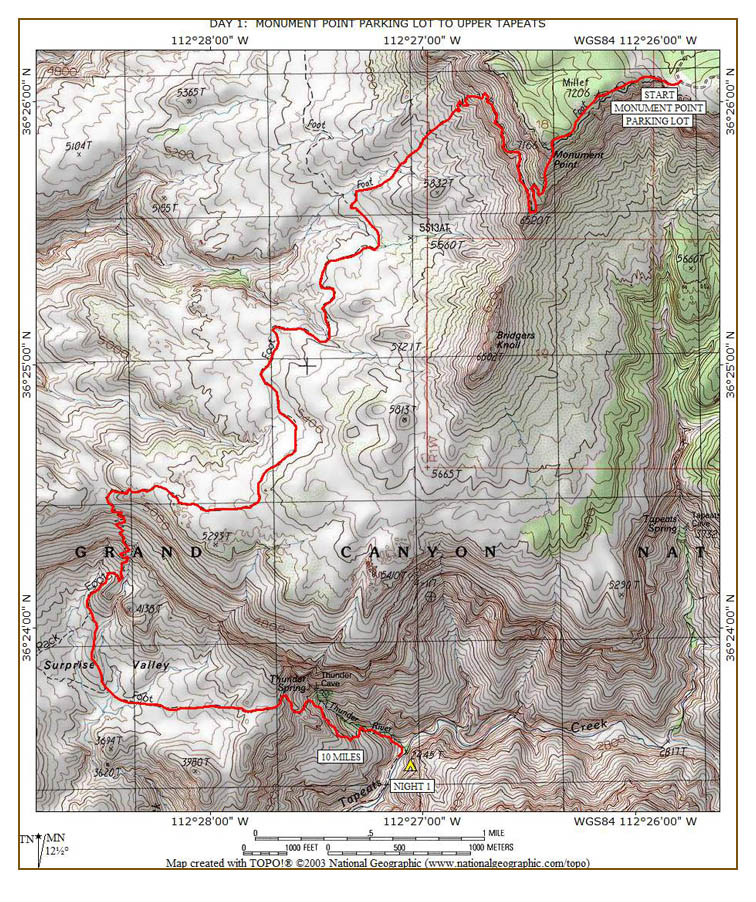
We are up at 5:00, pack our gear, eat
peanut butter and jelly sandwiches for breakfast, and drive to the Monument
Point parking lot. We are off at 6:15, a little bit before sunrise.
Because of the toenail problems I had on my April hike and the knee problems
on my hikes in 1999 and 2000, I am a little apprehensive. Hopefully
things will go better this hike. We walk through the open gate that
marks the start of the trail. The trail meanders around, up and down
for about a half-mile through an area where all the trees have burned.
In about 30 minutes, we reach the large cairn that marks the initial descent
through a very steep section with lots of loose rocks. The sun has just
come up, so that should help us going down this section. Most of the websites
we visited described how difficult this part of the trail is.
|
 |
 |
 |
|
Initial descent on tricky
section
10-6-2004 @ 6:48 |
Part-way down the descent
10-6-2004 @ 6:58 |
The bottom of the descent
10-6-2004 @ 7:16 |
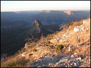
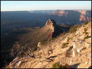
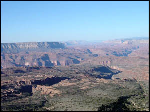
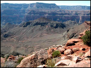
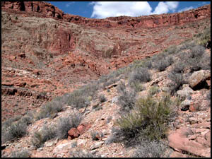
In about 30 minutes, we finish this initial descent and, while a little
challenging, it was not as hard as we have been led to believe it would
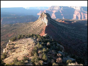
be. The view toward Bridgers Knoll is quite striking. The
trail now begins to loop around to the north for about a mile and remains
relatively level. Eventually we go through a few switchbacks and then
come to the small cliff section that drops down about ten feet. This is
the second section that all the websites say is fraught with danger. I
brought a rope to help lower our packs if needed. Art and I decide it
is about as easy to climb down this section with our packs on. We both
reach the bottom of the cliff safely with no problems. Again, while
somewhat challenging, it was not as difficult as we expected it to be. However,
I would agree that this is an area where extreme care should be taken as a
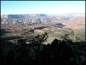
fall here would not be a pleasant experience. The view out across the
Esplanade is breathtaking.
|
 |
 |
|
Esplanade
10-6-2004 @ 8:05 |
Esplanade
10-6-2004 @ 8:06 |
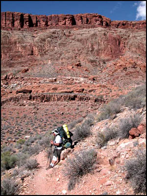
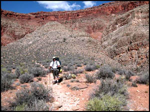
From this
point on, there is one large finger that descends to the Esplanade.
It is steep with numerous switchbacks and lots of loose rocks. We
found this to be one of the harder sections so far and very tough on the
knees and toes. Just as we reach the base of this finger, we meet up
with the Thunder River Trail junction. It is hard to imagine that
anyone would come down the upper portions of the Thunder River Trail and
hike the extra five miles it requires as opposed to the shorter Bill Hall
Trail. In only a few minutes, we are out onto the rock-hard portions
of the Esplanade. This requires following the rock cairns to stay on
the trail. As we approach a large drainage coming west from Bridgers Knoll, we find a cairn that suggests the trail goes down into the
drainage. It seems strange that the trail would lead down such a difficult
route into the drainage. Art and I look for other cairns, but finding
none, we begin the scramble down into the drainage. This is a
challenging experience and we take a rest break at the bottom. Equally
as challenging is the climb out of the drainage as its south walls are quite
steep. Eventually we make our way to the top and meet up with
the trail. Obviously someone has played a trick on us with that fake
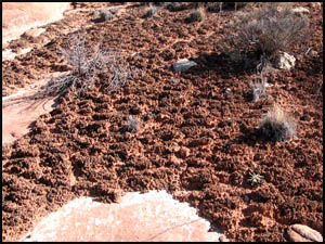
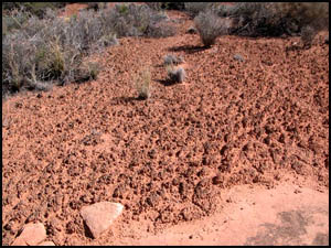
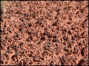
cairn. We are not amused. We immediately come across the
cryptobiotic soil
our permit advises to avoid walking on. It is quite unique: a fluffy
soil that appears to be growing upward.
|
 |
 |
 |
|
Cryptobiotic soil
10-6-2004 @ 9:34 |
Cryptobiotic soil
10-6-2004 @ 9:34 |
Cryptobiotic soil
10-6-2004 @ 9:34 |
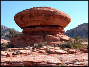
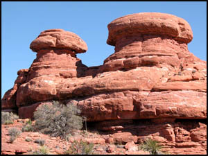
In another half-hour we come to Flying Saucer Rock. Just over half an
hour after that we reach the Mushroom Rocks. It's easy to see how they
got their names.
|
 |
 |
|
Flying Saucer Rock
10-6-2004 @ 10:06 |
Mushroom Rocks
10-6-2004 @ 10:45 |
We each cache two quarts of water behind a cedar tree and continue across
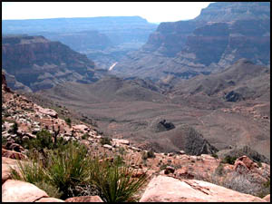
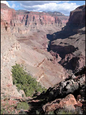
the Esplanade. Just before reaching the top of the Redwall, we have
lunch near where I expected to find the Lionshead rock. I never could
find it, though. A few minutes after resuming our trek, we reach the
top of the Redwall. The view looking down on Surprise Valley is
magnificent.
|
 |
 |
|
Surprise Valley
10-6-2004 @ 11:44 |
Surprise Valley
10-6-2004 @ 11:44 |
Art has been using water at a greater rate than I have and he is nearly
out. This is not a good sign as we still have a long ways to go
including descending the Redwall. The trail going down the Redwall is steep and
tough with lots of rocks. Near the bottom we meet two different
couples coming uphill. We remark to ourselves that their trip planning
is poor to be coming up the Redwall that late in the day when it is already
hot. Of course, maybe we shouldn't talk too loudly as Art is now out
of water and I have been sharing my last quart with him.
|
 |
 |
 |
|
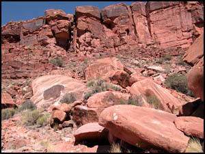
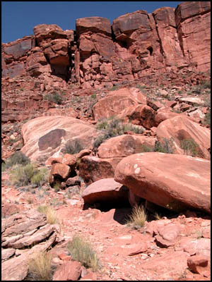
The Redwall
10-6-2004 @ 12:24 |
The Redwall
10-6-2004 @ 12:24 |
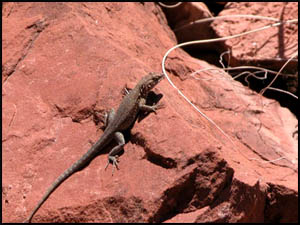
Lizard
10-6-2004 @ 12:15 |
|
 |
 |
 |
|
Looking back at the Redwall
10-6-2004 @ 1:24 |
Art resting near the trail
junction
10-6-2004 @ 1:24 |
Art just past the trail junction
10-6-2004 @ 1:30 |
It has taken about an hour and a half from the top of the redwall to reach the trail
junction in Surprise Valley. The elevation loss
coming down the redwall is nearly 1200 feet. The trail splits into two
segments here: east towards Thunder River and west towards Deer Creek.
We take the east fork. The trail is easy walking and relatively flat.
That is a good thing because our shared water has now run out and it is
getting hotter. It seems like we have been walking forever across
Surprise Valley. Although I walked right past it, Art sees the cairn that marks the
southeast triangular trail
junction for those coming up from Thunder River and proceeding to Deer
Creek. We do not want to miss that tomorrow. Art is now
completely fatigued and insists that I go on ahead to reach the water at
Thunder River while he stops to rest. I realize that it is not
normally a good thing to leave your hiking partner, but we really have no
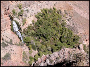
options at this point. I trudge along, finally reaching the ridge
overlooking Thunder River. Geez!! I cannot believe how steep that
descent is. It is every bit of a 60 degree incline. None of the
websites we visited warned us about the steepness and difficulty of this
last descent into Thunder River and Tapeats Creek. This is a mentally
depressing moment for me realizing how much work I have left to reach Thunder
River, much less to go on to Upper Tapeats Campground. I later look at the map
and discover the elevation loss from the ridge to Tapeats Creek is 1400
feet.
|
 |
 |
 |
|
Ridge above Thunder River
10-6-2004 @ 2:32 |
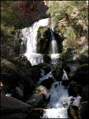
Thunder River
10-6-2004 @ 2:48 |
Thunder River
10-6-2004 @ 2:58 |
|
 |
 |
 |
|
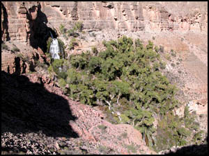
Thunder River
10-6-2004 @ 3:24 |
Thunder River
10-6-2004 @ 3:24 |
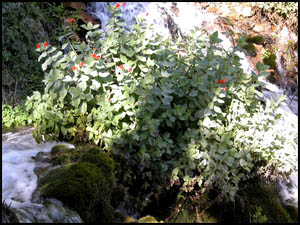
Crimson Monkey Flower
10-6-2004 @ 3:24 |
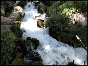
There are dozens of switchbacks to deal with the steepness of the trail.
However, my knees and toes have done reasonably well so far. I just
hope they hold up under this latest challenge. I finally reach the
cutoff to Thunder River about 45 minutes after starting down from the
ridge. It is very nice to have my pack off my back. I quickly
make my way to the river, filter some water, and drink all I can. I
then fill one of my two water bottles with filtered water and carry it out
to the trail. I am sure Art will be along before too long, although
I cannot see him looking up towards the ridge. He will be thrilled
to see that full water bottle sitting there in the middle of the trail.
I go back to the river and talk with a lady from Phoenix while having a
granola bar. After another 15 minutes, I am a little worried about
Art, so the lady and I wander back out to the trail. We discover
that my full water bottle is gone. I just hope the river runner who
came by a few minutes ago is taking it up to Art, because I will be plenty
mad if he has stolen one of my bottles. I finally see Art at the top
of the trail and a couple coming down also. If the couple beats me
to the bottom, I am afraid they will claim one of the better campsites, so
I put on my pack and head downhill as fast as I can. This increased
pace is now hurting my knees. It takes me another hour after leaving
Thunder River to reach Tapeats Creek. Hopefully the
campground is not too far. In another ten minutes, I reach the
campground and find that the first two of the three total sites is taken. I
plop down in the third site just as the couple pulls in behind me. I
wonder if they are off permit. Even though this is a small site, I
guess we can share it with them. Amazingly Art is right there with
them. It turns out they were concerned about Art's condition up at the
ridge and volunteered to carry his pack down. Where were they when I
needed them!! It also turns out that the river runner did deliver my water bottle
to Art, so everything worked out well. This couple is camped in the second site and had been doing a
day loop-hike down Tapeats Creek to the Colorado River, over to Deer Creek, and back up and across
Surprise Valley. It must be wonderful to be young and energetic.
Art and I set up camp and cook supper. Art is clearly exhausted and
admits he could not have made it down without their help. I kid him
the rest of the hike that the buzzards were beginning to circle over him back there
in Surprise Valley. We quiz the couple whether
tomorrow we should be doing the route they took for their day hike or sticking
to our original itinerary of backtracking uphill and going across
Surprise Valley. They feel our original plan is probably better
considering the poor condition our legs are in. Our total hiking time
today was eleven hours. It should be much shorter tomorrow. If I had
known how tough it was getting down here, I would have scheduled two nights
here. The mice are everywhere, so I put my food-stuff in my tent before going to
bed. You would think the Park Service would have metal boxes here to
store
your food. Art collapses into his tent and I don't see him again that
night.
MAIN INDEX
|
TRIP INDEX
|
BACK TO PREFACE
|
FORWARD TO DAY 2
|
Copyright © Richard M. Perry, 2004-2023. All rights reserved. This web site, its text, and pictures may
not be copied without the express written consent of Richard M. Perry. |
|